Horus 38: Flight Report – 13th November 2016

Horus 38 was to be the first flight in a long time featuring horus-logo-blackpayloads only for AREG and the Project Horus group. It also marked the welcome return of Terry VK5VZI to the project (who had been travelling for work for some time), who brought many new faces to the event. It was fantastic to see new people taking an interest in Project Horus.

However, as always it seems when we try these flights for ourselves, Murphy seems to come out to play, ensuring things dont quite go to plan…..

The Flight Outline

The payloads for this flight were planned to be the standard 100 baud RTTY beacon, the SSDV live imaging payload (with improved modem software), several GoPro cameras (we had one pointing up and one pointing out – the plan being to see the balloon grow in size through the flight), and we had our commandable standard flight termination payload. The main objectives were to get some more video footage for AREG’s own use, and to conduct a further test of the SSDV system under flight conditions.

Flight Preparation

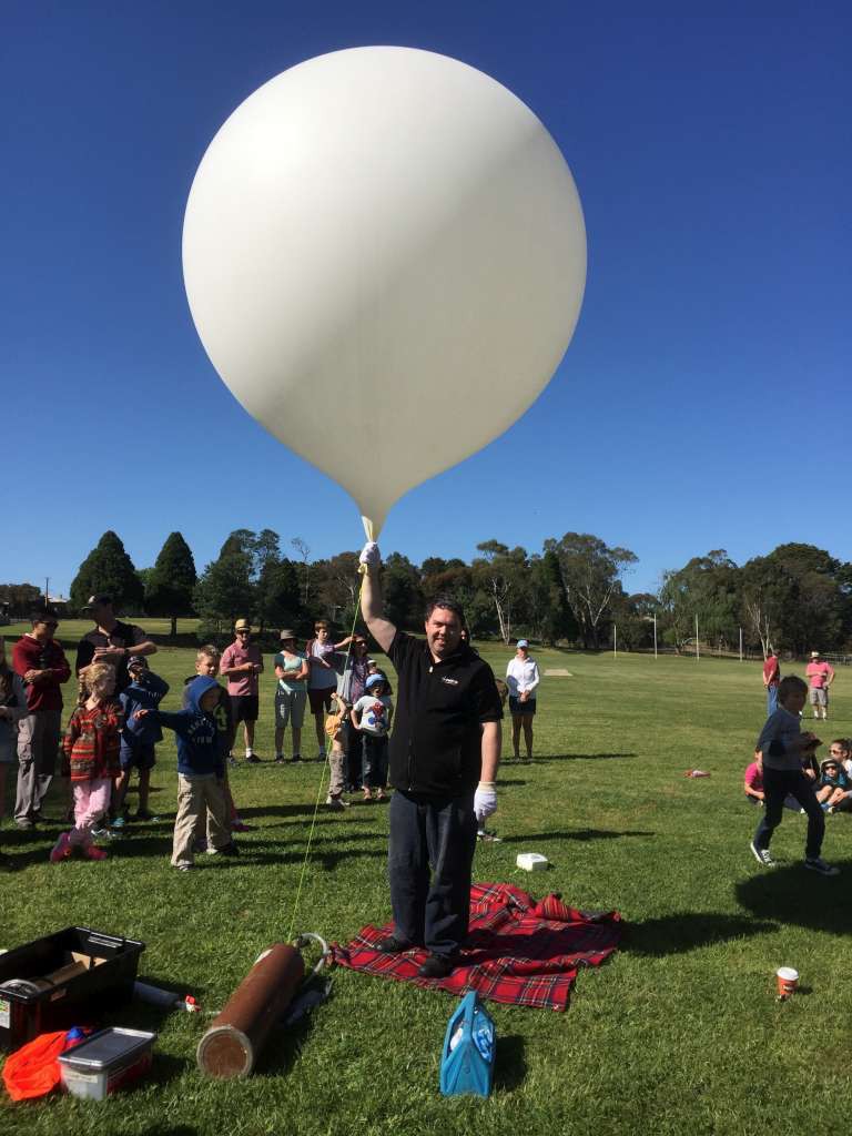
Preparations for lift off went smoothly and the balloon train was quickly assembled. Since all of the payloads had been pre-assembled, the weights of everything were already known which sped up the process of getting the flight off the ground.

SSDV Ground Station

In addition to the team at Mt Barker, we also had Peter VK5KX and Andrew VK5AKH setup at Palmer on the back of the Mt Lofty ranges ready to receive the SSDV telemetry and relay it to the Internet. We had high hopes that would improve the number of pictures we could capture during the flight.

Launch

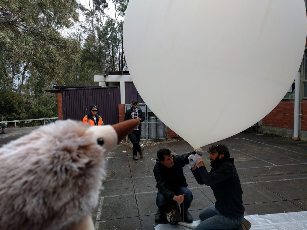
This launch, like Horus 37, was conducted under challenging conditions with squalls and wind gusts sweeping through the area prior to lift off. The surface winds were proving unpredictable, with periods of calm followed by 40-50km/h winds. We had successfully launched in conditions like this previously, but like all things, our luck had to run out eventually, and so it did this day!

At release, the wind picked up again at the wrong moment. While we avoided the payloads hitting the ground when letting it go, it then encountered a more serious obstacle. A final gust of wind pushed the balloon train into the path of a tree on the edge of the oval. For a second we thought it might just clear it, but no – alas it collected it full on. Then, after an agonizing 20-30 seconds, it freed itself (although not before mashing the polystyrene payload boxes fairly well), only to get snagged a second time in the next street. There it met it’s destruction when three of the four payloads were ripped from the balloon. The RTTY beacon, the SSDV experiment and the camera payload were all left mangled and grounded, while only the balloon cutdown payload continued on it’s flight.

David VK5DGR has “kindly” conducted a post mortem of the event on his blog which you can see here:

After going and collecting our battered payloads, we regrouped. We still had a balloon in the air to chase. So, with that, we reconfigured our chase cars and switched primary tracking to the backup telemetry feed. Unfortunately this precluded most amateurs from joining in (as the secondary is also the flight termination telecommand system and so is deliberately kept somewhat obscure for obvious reasons). We apologies for not being able to involve everyone this time. Dont worry, however, because there are two more flights planned for the very near future!

The Flight

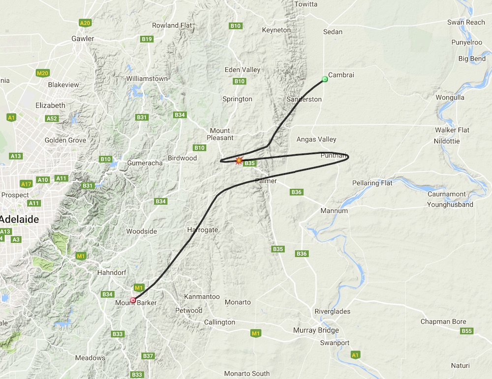
After the nasty takeoff, the flight itself went well. Murphy however wasn’t done with us yet. We had decided to bring the remaining payload down early, in order to make recovery as easy as possible. The button was pushed, the commands were acknowledged, but the payload didn’t detach! Hearts sank again as we realized we would have to track it all the way and hope that it didn’t land somewhere inaccessible. The pre-flight predictions were all based on the full payload weight being there. Once three quarters of it was left behind, the ascent rate became much higher, changing the landing zone (based on the original predicted burst height) considerably.

Luck wasn’t completely with Murphy however, and we finally had some when the balloon burst early of it’s own accord. At around 27km altitude, descent began, giving the ground crews a repreive and a relatively easy to recover landing location.

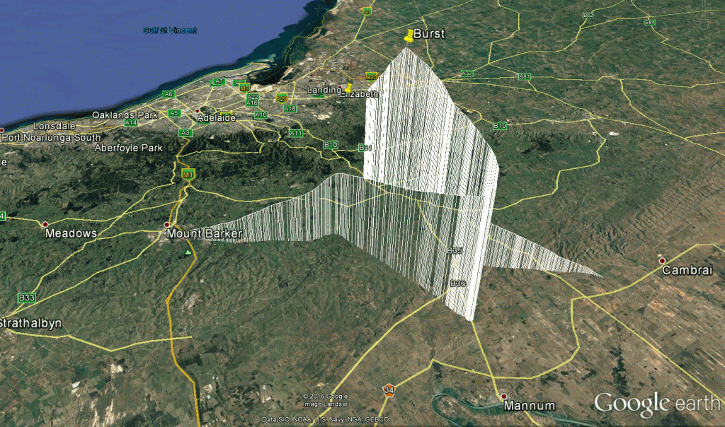
horus38-flightprofile

Flight Track Profile for Horus 38

The Recovery

At the end of the day, the teams converged on an empty paddock outside of Sanderston on the Murray Plains and collected the remains of the payload from the flight. Not an ideal day, but one which ended well with a successful recovery. The teams were close enough to actually see the balloon land, something we have missed for a few flights, so at least our tracking and tactical work is at the top of our game.

Flight Statistics

[table “” not found /]

Conclusion

There are lots of lessons to learn from this flight. The main one will be to reconsider the layout of the payloads on the balloon train. With three 70cm transmitters and one 70cm receiver we had taken to spacing out the payloads considerably. This long train is what compromised the take off, and ultimately lead to the partial failure of the flight. The team is also reviewing our flight manual to consider the surface winds in more detail. Ultimately, even after 38 flights, there is still more to learn. Thats the fascinating aspect of this corner of the hobby!

73’s till next time de Project Horus

Balloon Launch November 13th: Horus 38 – 10:00am ACDT

The Amateur Radio ExperimentersIMG_1767-1024 Group is planning another High Altitude Balloon Launch. Designated Horus 38, it will be an internal project team flight carrying payloads specifically for AREG members. Multiple payloads will be included.

UPDATE: Due to the high wind conditions at the launch site, most of the payloads did not make it off the ground (including the video and SSDV payloads). Currently only the LoRa Cutdown payload is in the air. Chase teams are en-route to recover this payload now. 

Live Tracking Links

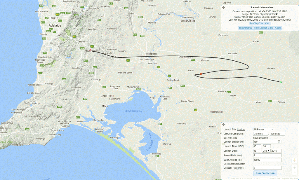
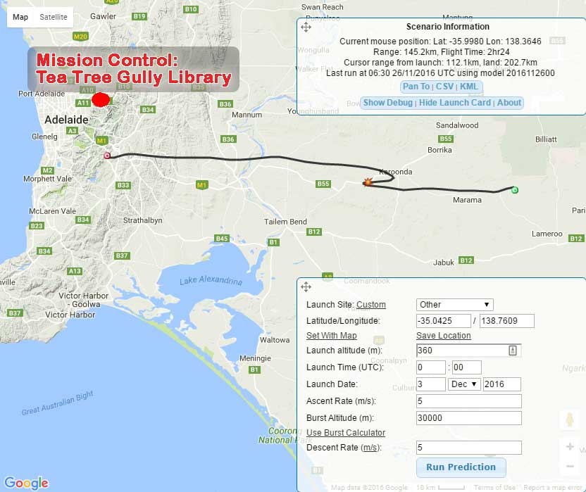
Flight Track Prediction

The following is the predicted track for the balloon tomorrow. We will be targeting a 5m/s ascent rate, a 30km burst altitude, and 7.5m/s descent rate.

SSDV Experimental Payload – ‘Wenet’

Mark VK5QI and David VK5DGR have been working on a slow scan digital image payload for the balloon system which transmits at 115kbit/s on a new downlink channel. This system makes uses of the UKHAS SSDV server to stitch together images from packets uploaded by multiple receivers. It first flew on Horus 37, and after some refinement will be flown again on this flight. Information on this system is available here.

HD Video Camera Payload

We are also going to fly an upward facing and an outward facing camera, and hope to collect images of the balloon expanding and (hopefully) bursting, as well as some HD video imagery similar to what was achieved back on Horus 12. Thanks to Scott VK5TST and Josh VK5JO for the loan of the GoPro Hero3 cameras for this flight.

RTTY Telemetry

The standard RTTY 70cm telemetry payload will be flying as well. Listen out on 434.650MHz USB, 100 baud  ASCII-7N1. You can get involved through capturing telemetry data and relaying it back to the chase team via the Internet (details on how to setup and operate dl-fldigi are available here: ukhas.org.uk/projects:dl-fldigi

Flight Details

Visitors from the Amateur Radio service are welcome to come along to the launch this time (as it is not for a school or other organisation). Launch details at this stage are below, however keep watching the website closer to the time for confirmation and up to date details:

  • When: 13th November (Sunday), approx. 10AM CDT launch time.
  • Where: Mt Barker High School Oval

[wpgmza id=”10″]

Horus 37: Flight Success!

We are pleased to report that the high altitude balloonhorus-logo-black flight of Horus 37 has been a success. The AREG Project Horus launch crew carried out the flight for Launchbox, a group which engages with the STEM programs (Science, Technology, Engineering, Math) in schools across the state.

http://www.launchboxspace.com/

Lift off was from Mt Barker High School at 10.00am, with landing occurring approximately 15km east of Mannum about 3 hours later.

8 payloads went aloft this flight. 5 from Launchbox and 3 from AREG. The new one for AREG was the experimental SSDV transmitter, which delivered live images from the balloon for a portion of the flight.

Launch

Launch was conducted under challenging conditions with squalls and wind gusts arriving about 20 minutes before liftoff. This caused considerable consternation from the launch team who were for a few minutes at risk of loosing or damaging the balloon before we had even gotten off the ground. However, through the skillful handling of the balloon by the AREG team, catastrophe was averted.

Once the balloon payload train was assembled, the countdown got underway. The weather eased and the flight finally got away safely.

Images from the Flight Ground Preparation and Launch

The Flight

The flight itself went well, although it had to be terminated earlier than planned. The team did not want it landing in the River Murray.

trackplot

Flight Track from half way through the flight

habhubtrack

Final Balloon Track – www.habhub.org

Lots of stations participated in the telemetry collection (thank you for your contribution).

SSDV Experimental Payload – ‘Wenet’

As indicated above, this flight carried a first time payload for AREG. Mark VK5QI and David VK5DGR have been working on a slow scan digital image payload for the balloon system which alternates between 19.2kbit/s and 115kbit/s on a new downlink channel. This system makes uses of the UKHAS SSDV server to stitch together images from packets uploaded by multiple receivers. To help this along during this flight, Andrew VK5AKH and Scott VK5TST headed to the back of the Mt Lofty ranges after launch and collected as much of the SSDV picture feed they could for relay to the internet.

Andrew VK5AKH and Scott VK5TST’s setup for SSDV

The SSDV capture software currently runs under Linux, with a screenshot of it running in a Virtual Machine on VK5QI’s CarPC below. The software is open source and can be found on GitHub. 

(courtesy Mark VK5QI)

In this case, the modem software is still very much under development, without any FEC capability currently. David VK5DGR and Mark VK5QI are continuing to develop the system and you may see it fly again in the near future with some enhancements.

The following is the Gallery of the shots taken by the camera received on SSDV during the flight:

This slideshow requires JavaScript.

The following are some of the pictures downloaded from the camera after the flight:

This slideshow requires JavaScript.

Landing and Recovery

The chase crew were lucky this time and were able to see the payloads land from about 400m away. It landed in a patch of scrub on the edge of a wheat field. After about a 1km hike we were able to successfully recover them. They landed in a patch of mallee scrub, so there was some judicious nudging required to bring them safely to the ground.

At the end of the day, here was the crew that undertook the payload recoveries

img_2959-medium

Flight Statistics

[table “” not found /]

Conclusion

AREG would firstly again like to thank Launchbox for the opportunity to be part of the STEM program in schools. We also want to thank all of the team who came out today in somewhat cold and wet conditions to get the launch off the ground. The team included: Matt VK5ZM, Mark VK5QI, Grant VK5GR, Andrew VK5AKH, David VK5DGR, Scott VK5TST, Kim VK5FJ, Gary VK5FGRY, Josh VK5JO and Scott VK5TST.

Thanks also to the amateur ground stations who made the effort to receive telemetry and provide it to the tracking data pool online:

VK5QI, VK5ZM, VK5KJP, VK5KX, VK5ZRL, VK5NEX, VK5APR, VK5ZEA, VK5AKH, VK5FJGM, VK5FLEX, VK5HS

Without you these flights are that much more difficult!

73’s de Project Horus

Horus 37: Flight Currently GO for tomorrow morning!

Preparations are continuing to fly a large helium balloon this coming Sunday from Mt Barker in South Australia. AREG will be flying the balloon on behalf of LaunchBox who are undertaking a schools science education program.

Lift-off is planned for 10am, with a flight path that currently looks like it will orbit the eastern Adelaide hills.

The only risk to the launch currently is the low level weather forecast. The Adelaide Hills area has received yet another significant rain band this evening. If this hasnt cleared by morning the flight start could be delayed. Watch this website for the latest news.

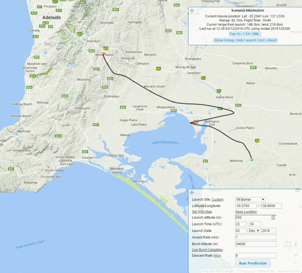
Predicted flight path, as per 2016-09-17 06Z GFS model. (5m/s ascent rate, 3.5m/s descent rate, 34km burst altitude)

Amateur Radio operators across SA and western Victoria as far east as Melbourne should be able to hear the telemetry transmissions on 434.650 MHz using 100 baud RTTY (7N2). If you decode the transmissions using the dl-flDigi program, you can contribute your received frames to the global pool of tracking data enabling us to follow the flight.

You can find a guide to tracking the balloon flight using the dl-fldigi software at the following link: https://ukhas.org.uk/guides:tracking_guide

As usual, the payloads can be tracked live on the Habhub Tracker, available here.

As an added bonus, this flight will be carrying an experimental payload transmitting 115kbaud FSK on 441.200MHz, downlinking live images from the payload. This payload has been in development by David Rowe (VK5DGR) and Mark Jessop (VK5QI) for some time, and utilises an open source modem stack. If all works as expected, images should appear on this page: http://ssdv.habhub.org/VK5QI

Project Horus Balloon Launch – Advanced Notice!

AREG members will again be involved DSC_6524with Project Horus, undertaking another high altitude balloon flight for some high school students on Sunday September 18th.

The Launch time will be 10.00am from Mt Barker, in the Adelaide Hills.

Amateur Radio operators from across SE Australia can get involved in the flight by contributing to the telemetry gathering effort. Tune your 70cm SSB radios to 434.650 and decode the RTTY telemetry using the dl-fldigi software.

Keep watching the AREG website for further details and confirmation of the flight day (flights can be cancelled up to 24hrs before liftoff if adverse weather is predicted).

High Altitude Balloon Launch WEDNESDAY 27th July with Willunga High School

AXxwbdB

Andy VK5AKH and Mark VK5QI preping the balloon

Willunga High School undertook a high altitude (well, not so high this time…) balloon launch Wednesday the 27th July, with some tracking support provided by AREG’s Project Horus flight team.

Willunga Balloon Prediction July 2016

WHS Balloon Flightpath Prediction

This flight was organised mostly (gas + balloon + payload + CASA) by a science teacher from the high school, with assistance from myself (telemetry + recovery). The launch being mid-week certainly doesn’t make it easy from our side, so at the moment the tracking crew consists of myself, Gary, and the Adelaide division of IBM Ozlabs (Joel Stanley and Andrew Jeffery).

The flight carryed a GoPro plus the usual tracking & cutdown payloads, beneath a 300g balloon. We expected a burst altitude of around 20km, with a predicted landing zone to the east of Swan Reach:

This was a fairly long distance flight for the predicted altitude, but the predicted flight path holds the promise of some pretty good video of the Adelaide area (assuming the ‘partly cloudy’ prediction happens). The VK5QI chase crew was on the road to Swan Reach roughly 30-45 min prior to the launch time, to get in position to both cutdown (if required) and recover.

mzzX6zR

During the Chase and recovery


Update: The Flight was a Success!

The flight has been a success and the payload was recovered (albeit a little further away than planned, about 10-15km south of Waikerie). Here was the actual track route from the chase:

Flight Path

Flight Path

The AREG crew helped with filling the balloon as well at the School. Here are their ground crew efforts

The following gives you an idea of some of the frames collected by the camera for the school!

And the following is the recovery action

Thanks to Gary VK5FGRY, Mark VK5QI and Andy VK5AKH for the photos!

AREG & Project Horus at Linux.conf.au 2016 Geelong

Tux-simpleMark VK5QI and David VK5DGR attended thehorus-logo-black linux.conf.au conference again this year, this time held in Geelong. At the conference Mark gave a presentation on the balloon tracking systems that Project Horus uses. David then gave an introduction to what he is doing with the new binary telemetry system that has been flown experimentally on the last couple of Horus flights.

You can watch Mark’s presentation here!

David’s talk can be viewed here:

AREG-Horus SHSSP Balloon Flight – Summary

ISU LogoThe Australia Day launch of the Southern Hemisphere Space Studies Program high altitude balloon payload under an AREG / Project Horus balloon was a great success! Launched from the Mt Barker High School, in the Adelaide Hills, it was an almost “text book” launch.

AREG Flight Support Preparation

The AREG launch team were on site early in the morning to prepare for the event.  Matt VK5ZM made sure very knot was tied correctly while Mark VK5QI, Scott VK5TST and Ben VK5BB prepared the AREG payloads. Andrew VK5AKH and Gary VK5FGRY helped set up the event “environs” with the marquee and bollards/bunting to guide the crowd that was expected. Grant VK5GR meanwhile recorded the event (and will be making a short launch video soon). The flight used a 1600g latex balloon and was “powered” by Helium. Two AREG payloads flew, being the primary RTTY telemetry on the 434MHz band and the telecommand LoRa package used to control early flight termination if the need arose.

This slideshow requires JavaScript.

[fve]https://vimeo.com/153665896[/fve]

The AREG crew were joined by the SHSSP participants and event organisers from the University of South Australia and International Space University a little later in the morning.

ISU Students getting involved

Balloon filling operations were supervised by Mark VK5QI who enlisted the help of several of the ISU students to control the balloon as it went through flight preparations.

This slideshow requires JavaScript.

ISU Payload Preparation

The ISU payload included multiple SHIRTLOGOsensors and a telemetry transmitter of it’s own. There were three cameras onboard, a video camera looking down and an IR camera looking down and a stills camera looking out. The payload telemetry consisted of a 9600bps VHF data feed that the Uni was testing on the 2m amateur band (for a future Cubesat mission). The controller for their payload was based on a Raspberry Pi. The end result was impressive considering the students had little more than a week from concept to realisation!

This slideshow requires JavaScript.

Balloon Launch

The launch was attended by visiting dignitaries from the Mt Barker Council including Mayor Ann Ferguson, various media reporters from several TV and radio networks and by more than 150 members of the public. It was presided over by John Connolly from NASA who is their ISU representative, as well as Associate Professor David Bruce from the University of South Australia.

The launch itself went faultlessly, with the surface winds dropping off at the last second to make it an easy gentle vertical ascent.

This slideshow requires JavaScript.

Flight Tracking

habhubloogoA major contribution to the success of the flight was the reception and relaying of tracking data from a large network of amateur radio stations across South Eastern Australia.

To enhance the sense of involvement by the amateur radio community, the AREG operated the main telemetry beacon under the special amateur radio callsign of AX5ARG-1, to mark the occasion of the launch taking place on Australia Day. This captured the imagination of many first time tracking stations. It was great to see over 35 stations, including many first time contributors adding to the successful collection of flight telemetry.

AREG will be offering a special commemorative QSL card to mark this flight to all stations who can show they receive the telemetry. If you managed to upload data to HabHub.org then you automatically qualify. However, if you copied telemetry but didn’t manage to get it into the HabHub system, please send an email with a screen shot or captured telemetry frame to vk5gr@wia.org.au for inclusion in the SWL QSL card logs.

VK5RM-Screen Shot 01-26-16 at 11.36 AM

Screenshot of tracking courtesy AX5RM (relayed from VKLogger Forum)


launch 2Stations who heard the balloon and reported via HabHub:

AX5APR, AX5DC, AX5DF, AX5DMC, AX5FAJH, AX5FJ, AX5FO, AX5FSCK, AX5KX, AX5RM, AX5RR, AX5ZAR, AX5ZEA, VK3OF, VK5AKK, VK5AO, vk5dgr, vk5esh, VK5EU, VK5FAAP, VK5FAJH, VK5FAo, VK5FJGM, VK5FO, VK5FPAW, vk5ftaz, vk5hs, VK5HSE, VK5KJP, VK5NEX, VK5QI-9, VK5RR, VK5TST, VK5ZM, VK5ZRL


AREG member Peter, VK5KX also made a major contribution establishing a remote telemetry command post high atop of the eastern rim of the Mt Lofty ranges. From there he was able to not only collect telemetry but also help the ground chase crews with liaison communications. Thanks Peter for your important contribution.

rrc-VK5HS-trackingteam-20160126_114429AREG’s good friends out at the Riverland Radio Club also made an impact not only with tracking but through publicity on ABC Riverland radio as well! Thanks Ivan VK5HS and the team!


Chase and Recovery

Finally, probably the most significant taskballoontrackshssp-2016 considering all that had gone before, was to recover the payloads once they landed. Three tracking teams were out in the field lead by Matt VK5ZM/Grant VK5GR in car 1, Mark VK5QI/Gary VK5FGRY/David VK5DGR in car 2 and a team from ISU in car 3.

The chase was one where best laid plans changed at the last minute. By quirk of fate, the VK5ZM team didn’t actually obtain the wind predictions used to drive the tracking system until after the 1800Z Global Forecast System model was released, which gave us a surprise. Overnight, the jet stream had intensified, which resulted in the balloon traveling ~25km further down-range than planned. This changed our chase route quite substantially at the last minute and instead of targeting Bow Hill, the VK5ZM team headed for Karoonda. Meanwhile the VK5QI team which had departed earlier was already heading for Bow Hill.

This slideshow requires JavaScript.

In the end, the two AREG recovery vehicle teams rejoined each other out on the road and were on site before the balloon landed. However, due to local terrain and access restrictions, we did not catch sight of the parachute landing this time. The recovery teams had 3km of rough 4WD tracks and paddocks to negotiate and a further 2 km round trip hike through the thick Mallee using classic radio direction-finding techniques to navigate to the payload and then back to their vehicles.

Flight Statistics

[table “” not found /]

[fve]https://vimeo.com/153663387[/fve]

Thanks to all involved!

The SHSSP and AREG teams were ecstatic over the success of the event and there was also very good media coverage. Stories were aired on ABC891 radio in Adelaide and on ABC Riverland (thanks to the Riverland Radio Club who were following the event) as well as on NWS9-TV Adelaide and the ABC-TV South Australia news. The SHSSP event organisers were thank-full to the AREG for their contribution to the success of their stratospheric balloon launch project.

Many thanks must also go to all amateur radio operators who tracked and uploaded the telemetry data as well as to the UK High Altitude Society who built, maintain and provide access to the habhub.org system for tracking balloon flights!