Once again the Amateur Radio Experimenters Group entered the Oceania DX Contest from a portable station established on the ranges ~100km north of Adelaide. The group established a DX capable HF station with verticals on 160/80/40m and beams+verticals on 20/15/10m at full legal power (400W) with the explicit aims of:
- experimenting with antennas and antenna systems
- training operators in contesting
- experimenting with filtering and transceiver configurations
The planning for the event starts several months out with a planning night held back in the club rooms. Each band is assigned a captain who leads the group responsible for that particular station. All up about 20 members are involved in some way in the design, construction and operation of the multi-multi portable station.
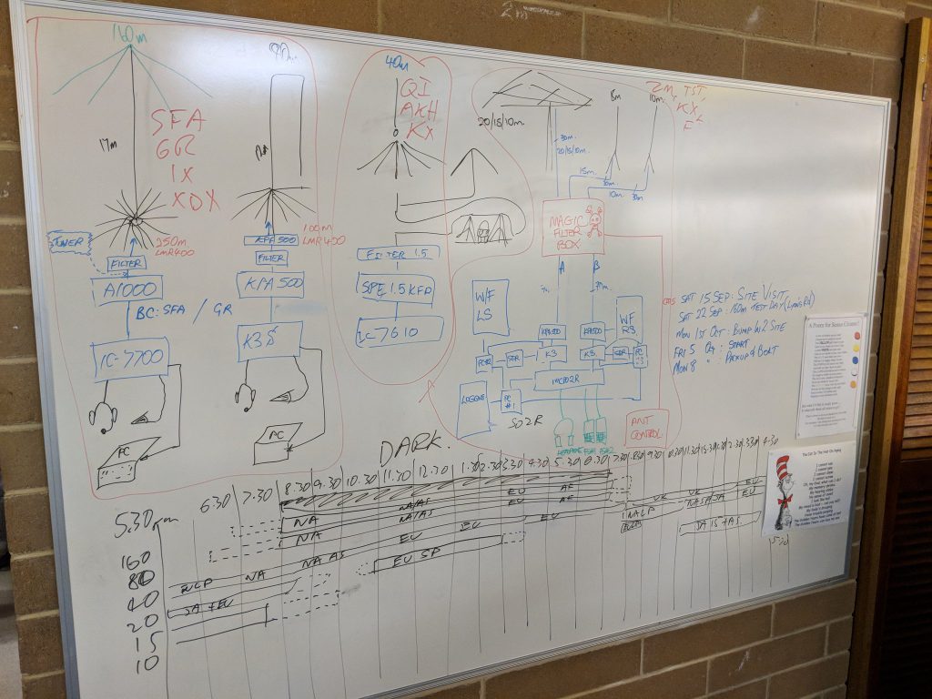
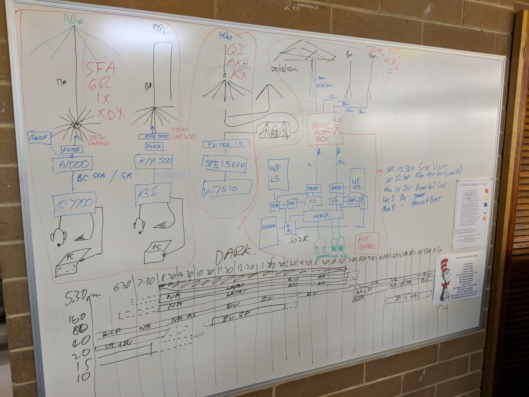
Propagation and Station Design Night
Low Band Station Development
Testing the 80m vertical
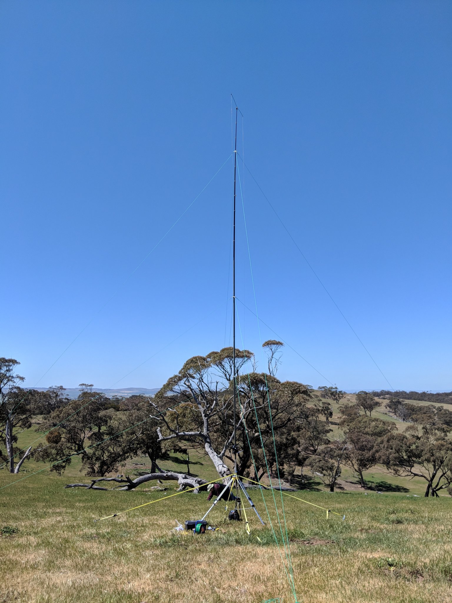
Each year a new part of the system is constructed. This years major advancements occurred firstly with the low band station lead by Steve VK5SFA and Grant VK5GR (160/80m). New vertical antennas were designed and tested, with the 80m antenna being trialed during the Trans Tasman Low Band Challenge contest in July. 80m was based on a folded 1/4 wave vertical monopole with elevated radials derived from a modified crankIR vertical.
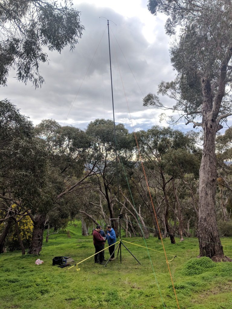
The 160m antenna was based on a capacity hat loaded 17m vertical (derived from designs by DJ0IP). After several working bees Steve gathered a group together and staged a test and tune day in a local park in Adelaide a few weeks before the event.
The addition of these antennas this year replaced the dipoles used last year. The intention from moving to verticals was to lower the angle of radiation, thus (hopefully) improving our chances for DX. The low band station was then ready for action.
High Band Station Upgrades
On the high band station Matt VK5ZM was scrambling to complete the design of the antenna switching network for the SO2R (Single Operator 2 Radio) 20/15/10m station. This system is unique in that it manages the antenna switching between both bands and radios to enable one operator to call CQ on two bands at the same time. Last year was the first time “the beast” as it is known was tried. This year the rest of the automation needed to be completed with the antenna selection and switching boards. Matt worked tirelessly to complete the system integration in time.
After all the preparations we were ready for the contest weekend.
Day 1 – Friday – Construction begins
With a virgin site to occupy, members started out early from Adelaide on the Friday. The first antenna to make it into the air was the 80m vertical, ready by about 11am. Oly VK5XDX, Steve VK5SFA, Grant VK5GR and Mark VK5QI all helped getting the first array into the air. Team 2 then arrived and started on the 40m antennas while Team 1 started on 160m. Lead by Andy VK5AKH, the 40m team included Peter VK5KX, Gerard VK5ZQV, Paul VK5PH and Scott VK5TST (who also set up the camp kitchen).
80m vertical
The 40m team got cracking and in short order got their first antenna in the air as well, which was an inverted V intended for domestic contacts (much higher angle of radiation).
40m inverted V (for domestic contacts)
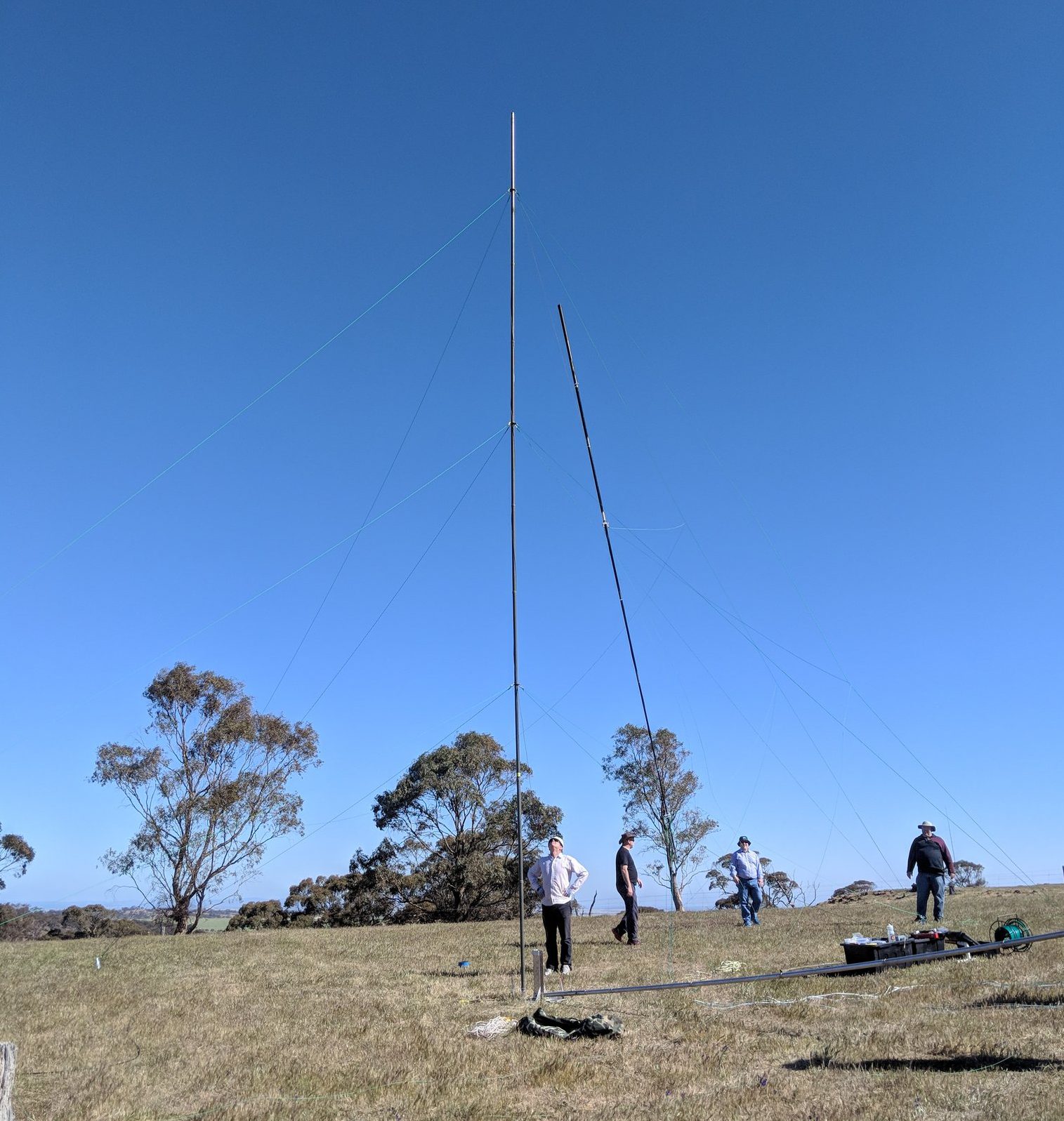
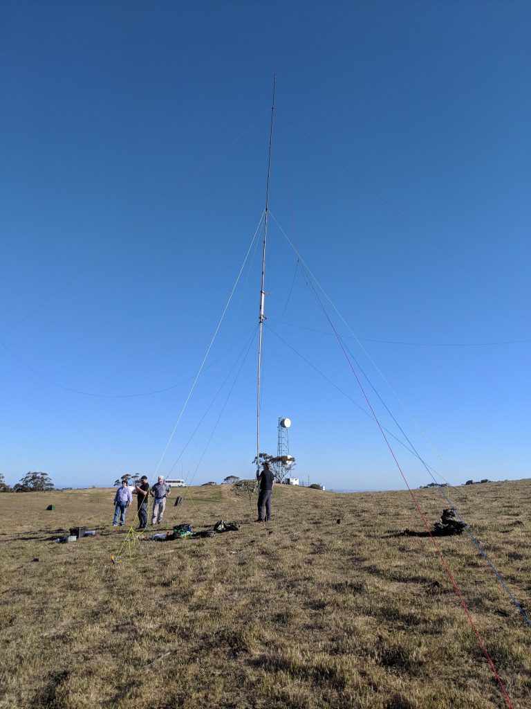
While the inverted V went up work progressed preparing to raise the 160m antenna. This was the first trial of the weekend. As the antenna was raised, the top 7m section which was made from a 9m squid pole failed. The top hat wires were proving to be quite heavy and hard to control as the tower was raised using a temporary derrick.

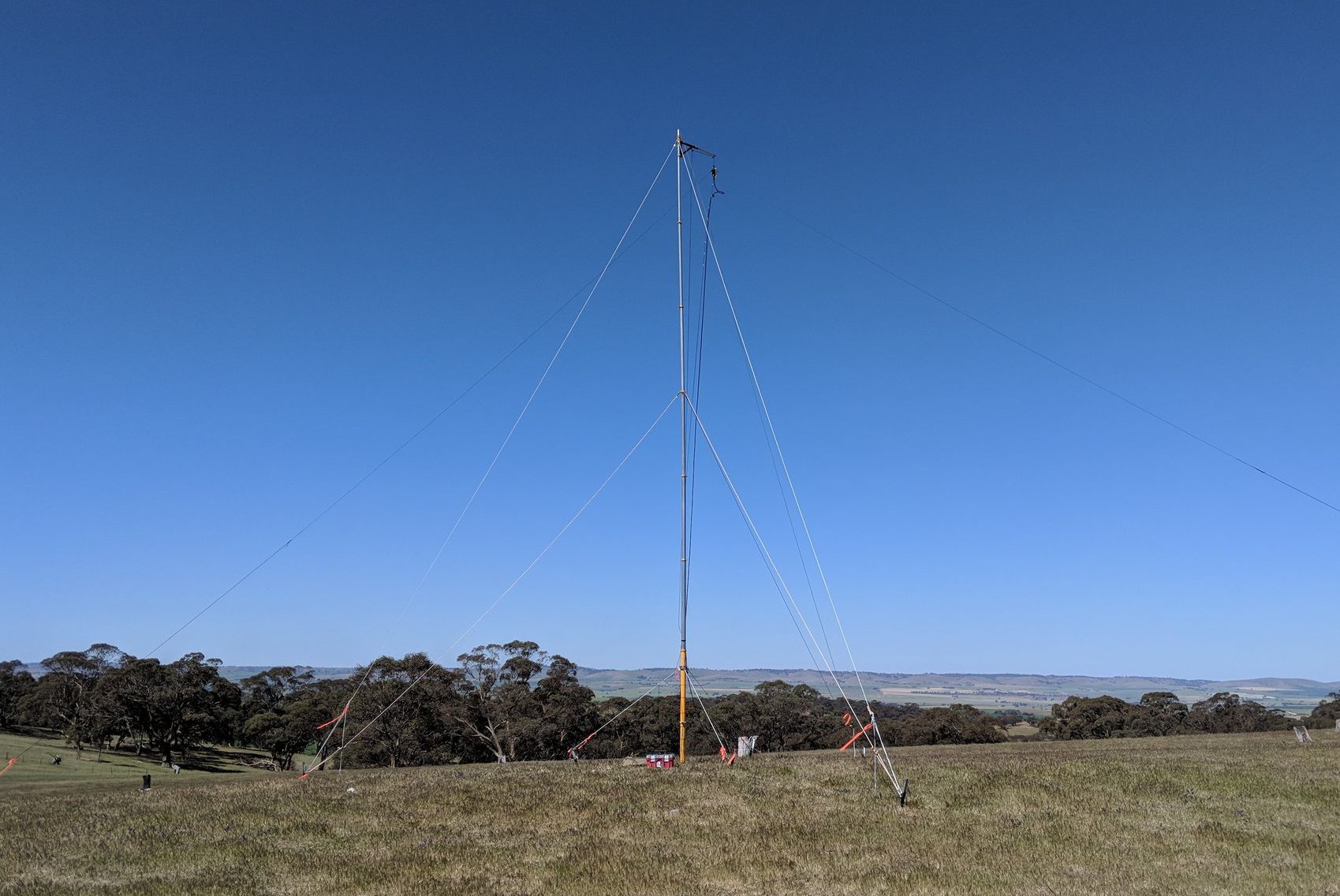
160m Erection Failure No.1 (17m version)
Fortunately the squid pole wasn’t damaged and we were able to lower the array and reset for a second try. Unfortunately Murphy had invaded the site and the next 3 attempts didn’t go any better, with the 4th try seeing the demise of the squid pole as it shattered. The moral of the story was that Squid poles are just not sturdy enough for this application,and the capacity hat wires should be made of lighter materials.
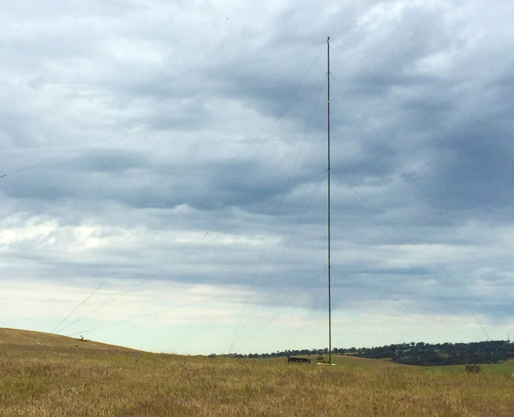
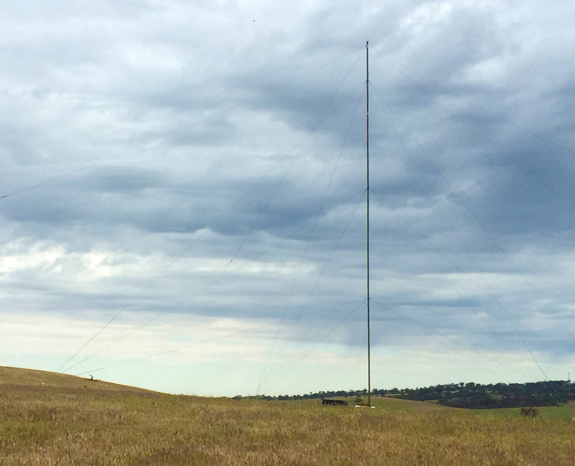
160m top hat loaded vertical (12m version)
Facing the prospect of no 160m antenna at all, the team hit upon a plan to put up a 12m version of the antenna, and compensate with the antenna matching unit. Finally on the 5th attempt with the light failing the antenna and its 700m worth of radials came into resonance with a good VSWR. Time would tell whether it would radiate well the next night as the contest started.
Team 2 on 40m meanwhile was having more luck. Their second antenna was an elevated feed 40m quarter-wave vertical with elevated radials. After realizing a couple of components of the feed system had been left behind, some bush mechanics were performed and the antenna climbed into the sky.
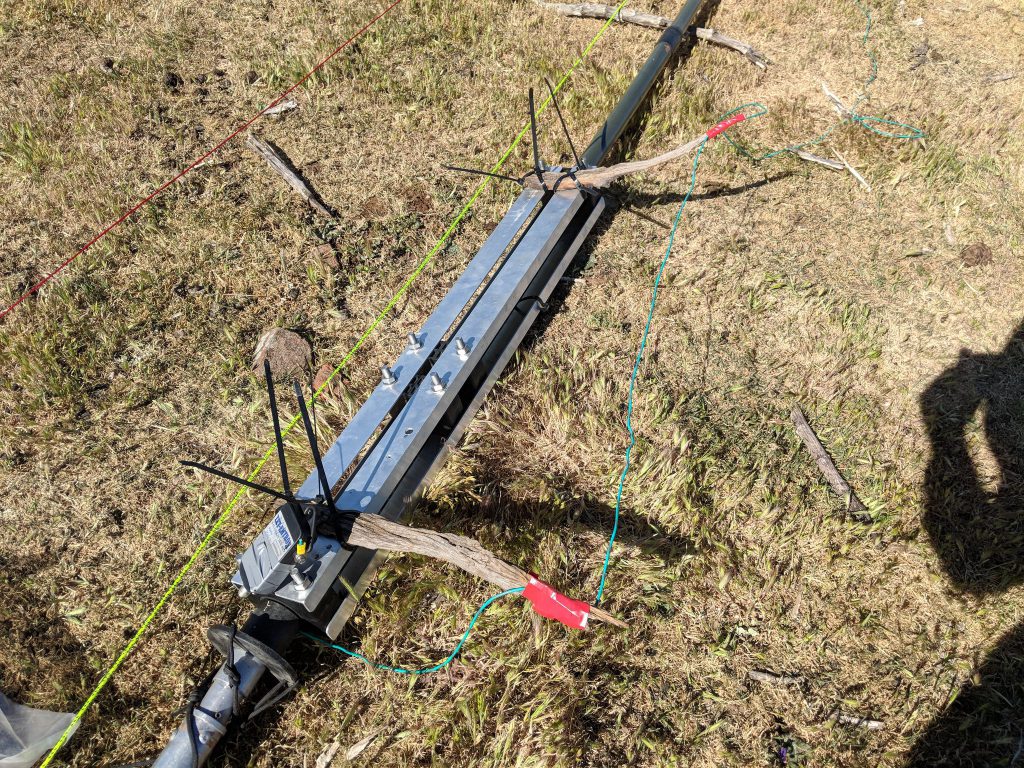
Makeshift 40m feed point mounts
40m vertical
The WIFI coax relay switch was installed and the LMR400 feeders for both 160 and 40m were run nearly 200m back to the operating hut.
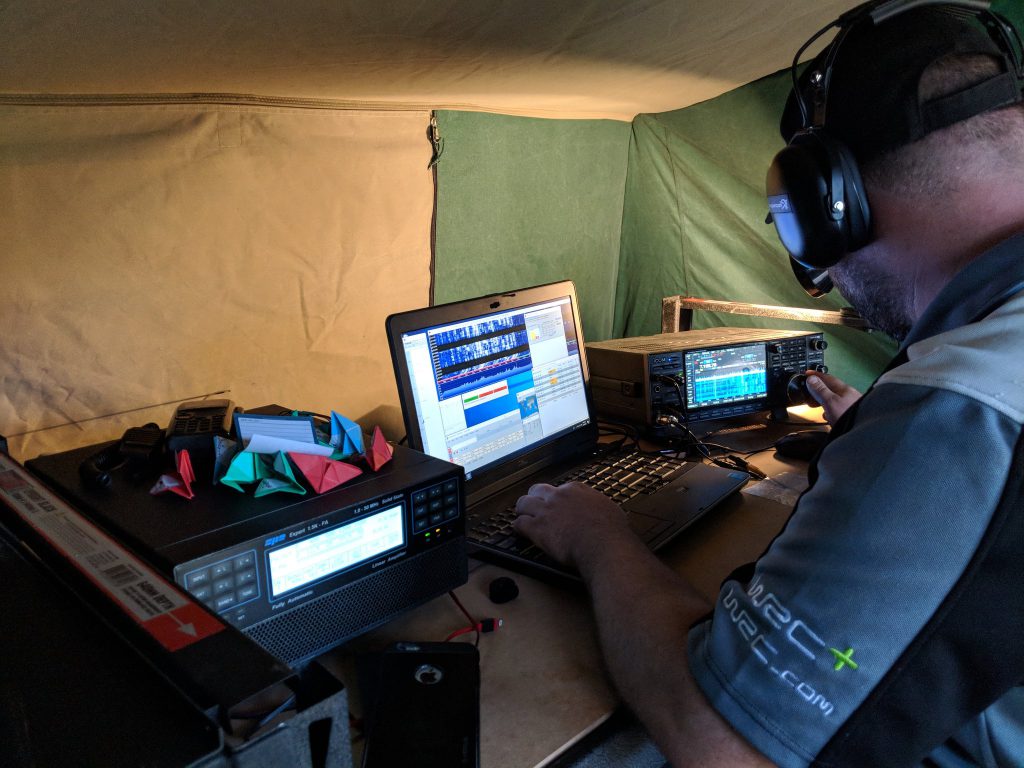
Finally, the 40m station was setup and the team began test contacts during Friday night using a ICOM IC7610 and SPE 1.3KFA linear followed by a Low Band Systems 1500W filter.
Andy VK5AKH driving 40m
Compared the last year we were back on schedule with all antennas in the air for 160-40m by the end of day 1.
Day 2 – Saturday – Construction and Contest Start
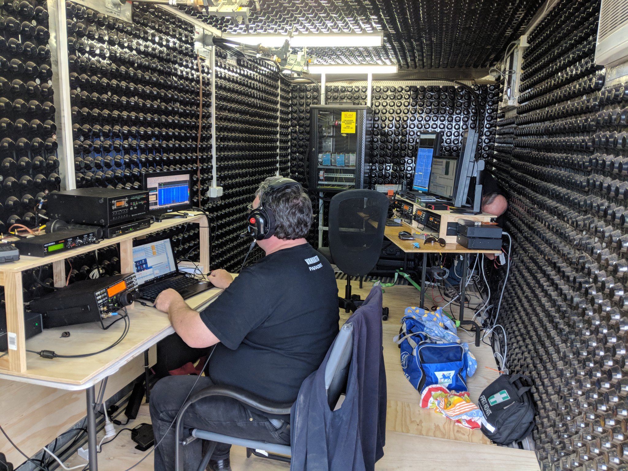
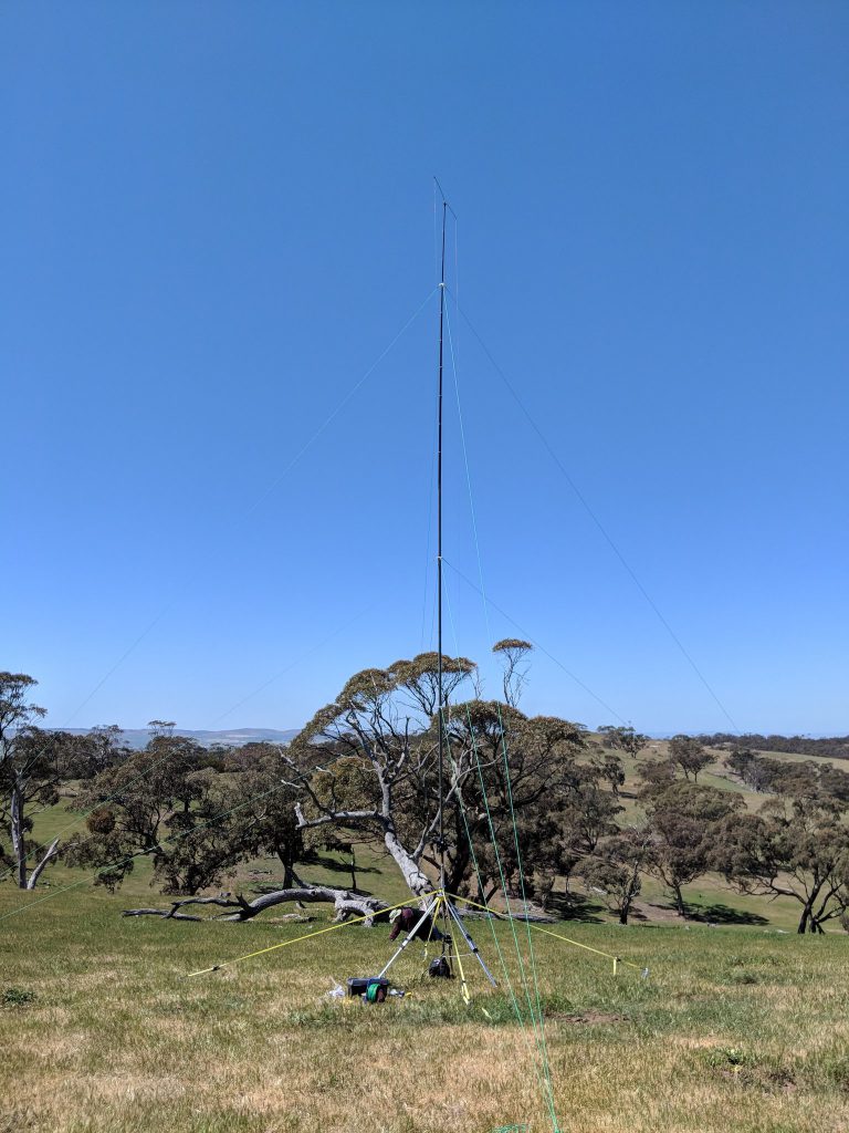
Saturday saw more of the construction crew arrive and work start on the high band station as well as loading all of the radios into the operating cabin. Matt VK5ZM arrived with his done Daniel VK5FDNA and then the team was joined by Darin VK5IX and Kim VK5FJ who bolstered the crew building the high band station. By now there are people everywhere (so if I have missed someone please let me know so I can add you). By lunchtime the last of the antennas were deployed with the verticals setup for 21 and 28MHz and the tri-band spider beam was in the air for 20/15/10m. The antenna combining and switching network was also established.
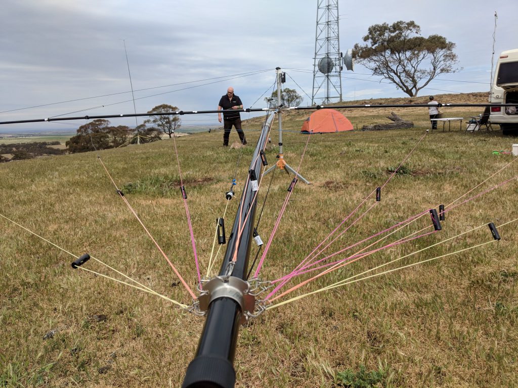
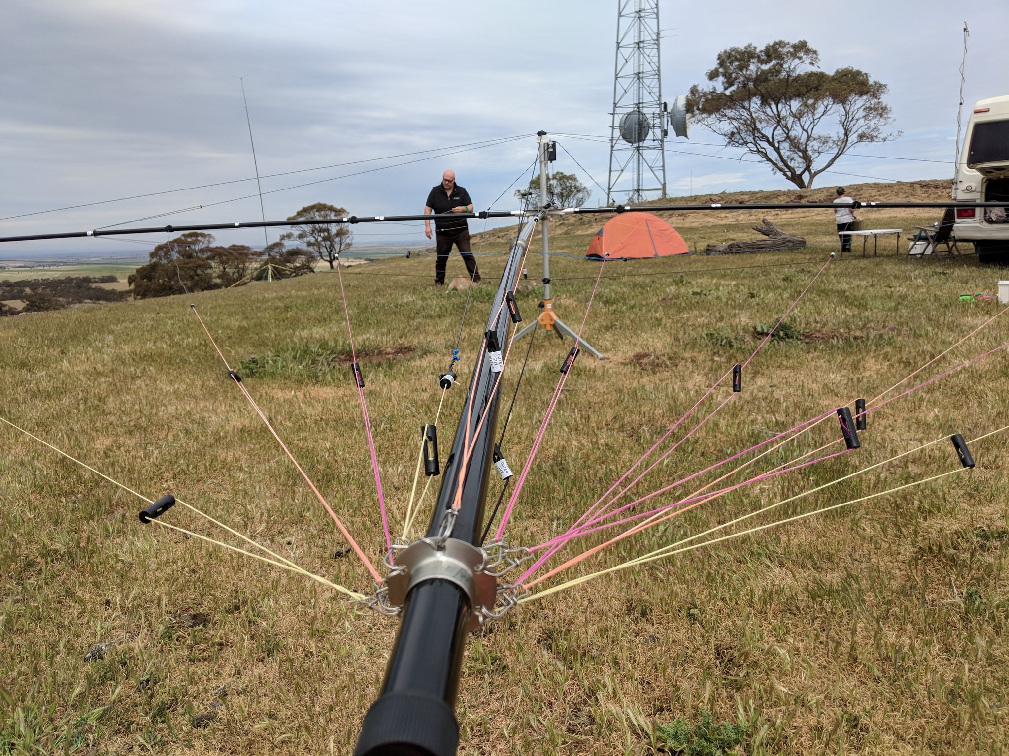
Rigging the Spiderbeam
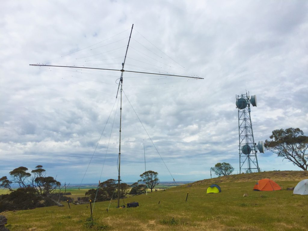
10/15/20m Spider Beam with 80m and the microwave site in the background
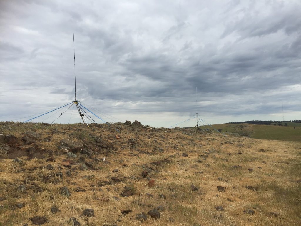
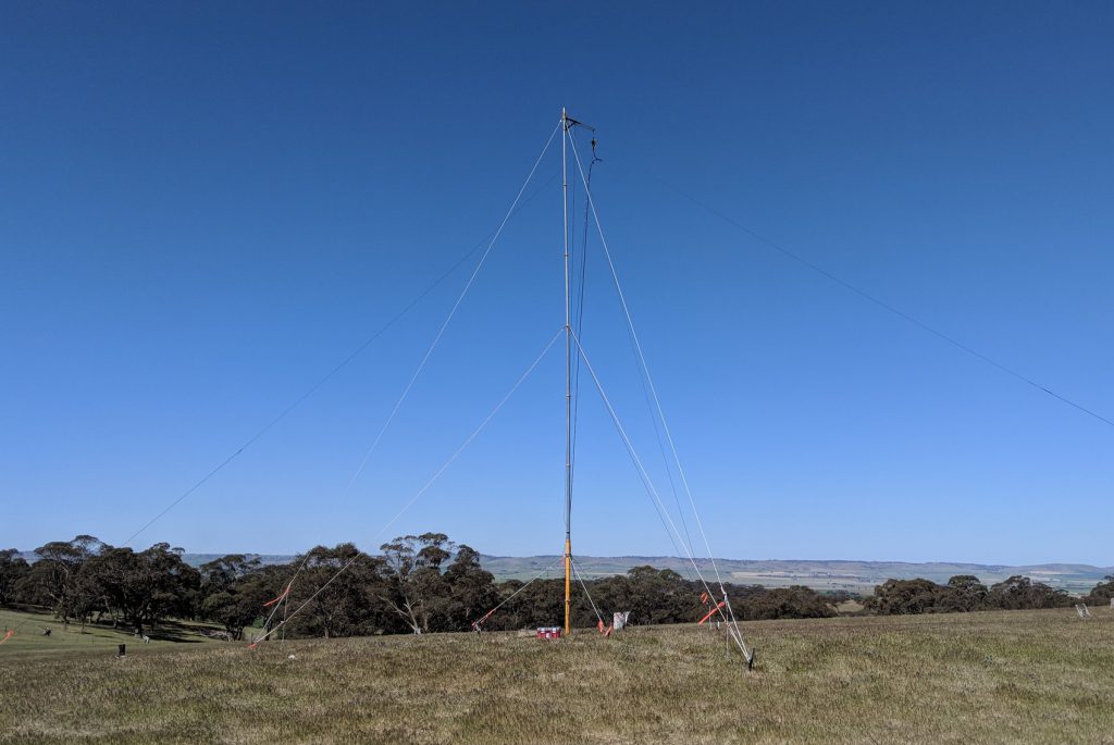
10 and 15m verticals – phased with the Spiderbeam
To support the station, a tent city was assembled providing sleeping quarters for the radio crew. Site logistics were managed and the kitchen staffed by Scott VK5TST. A key aspect of the event is to keep the team well caffeinated and fed. Assisted by Sharon VK5FSAW who shopped and planned the menu, Scott kept everyone plied with everything their stomachs desired.
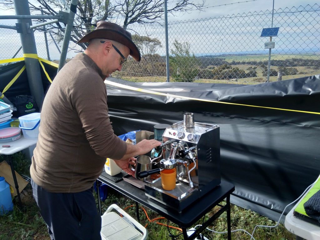
Scott making “GOOOOD” Coffee
So far this year the team had been blessed with excellent weather as well. Unlike last year when the station was built with 30-40knot winds howling over the hills, it was mostly calm this year making construction much easier.
Finally, as the start time approached, the finishing touches were put on the station and facilities. 40/80 and 160m opened up on queue at 0800z and the contest began.
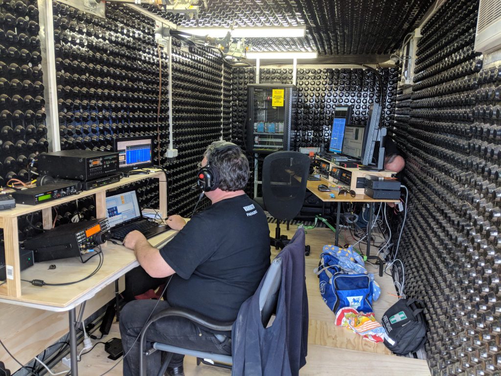
Murphy however decided to show his hand again, this time around the high band station. PTT switching issues were uncovered at the last minute and unfortunately the TR switching was damaged in one of the SO2R station amplifiers. Matt VK5ZM struggled on but in the end the last minute rush to complete the development of the antenna switching network the preceding week meant that there just wasn’t enough time to debug the rest of the SO2R station. About 30 minutes into the contest the sad decision was made to demote it to a single radio. This delayed activating the 20m station by about an hour. None the less, once all was ready away we went with 3 active operating positions across 4 bands (with manual switching on 80/160m).
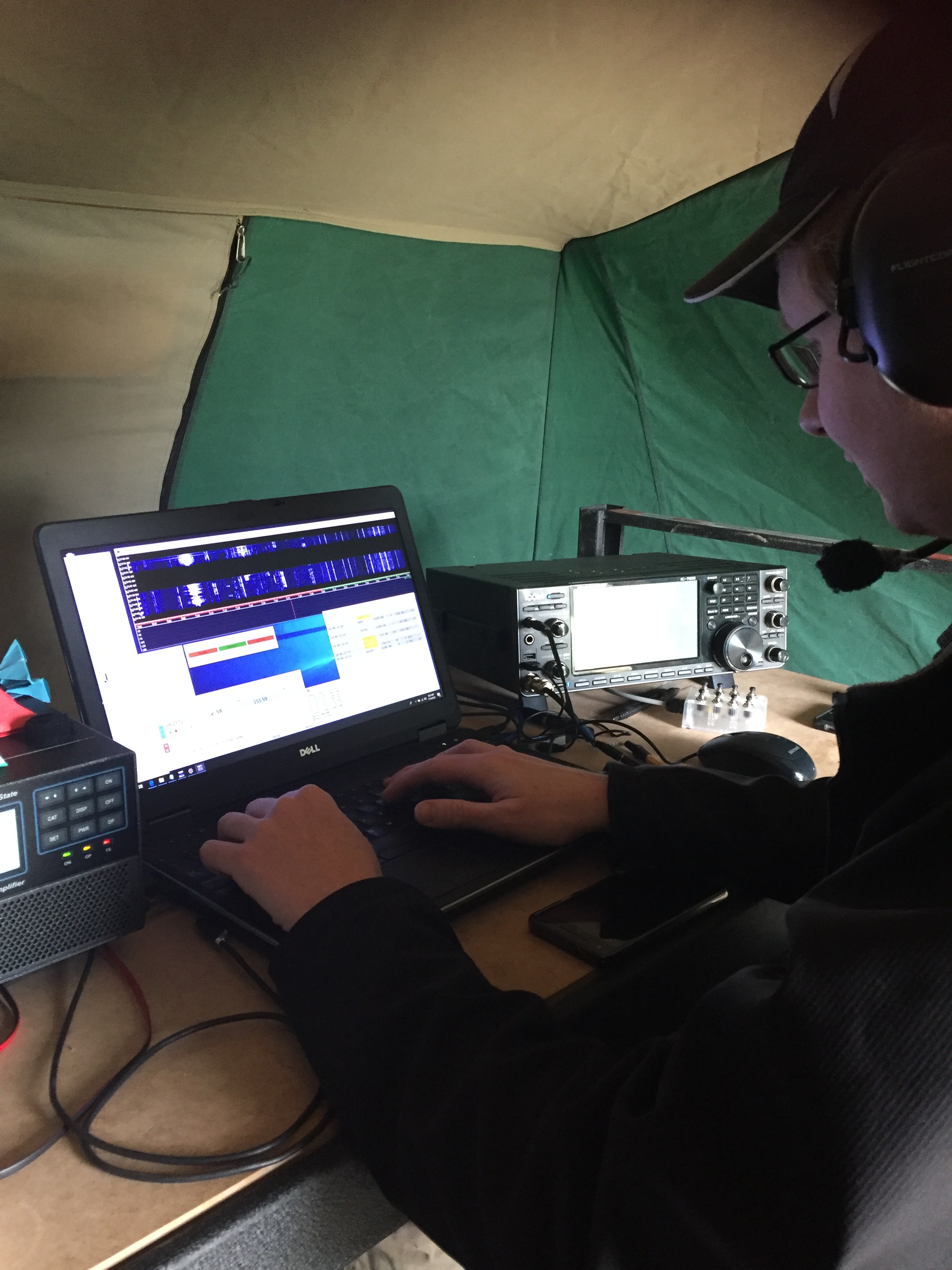
Night fell, dinner was served and everyone settled into the routine of calling CQ. Oly, who was a new contester in the team quickly proved he was a machine on both the 160/80 and the 20m station while a steady crew manned 40m.

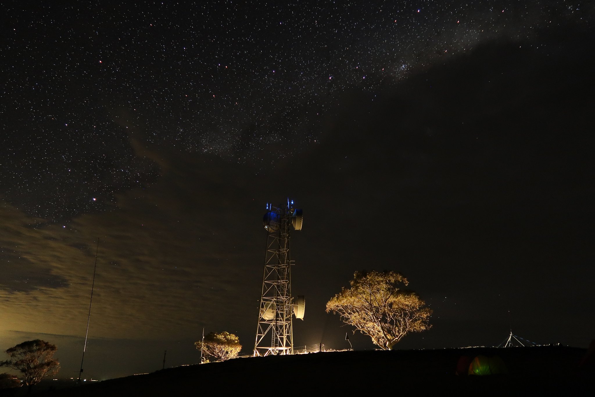
VK5ARG by night
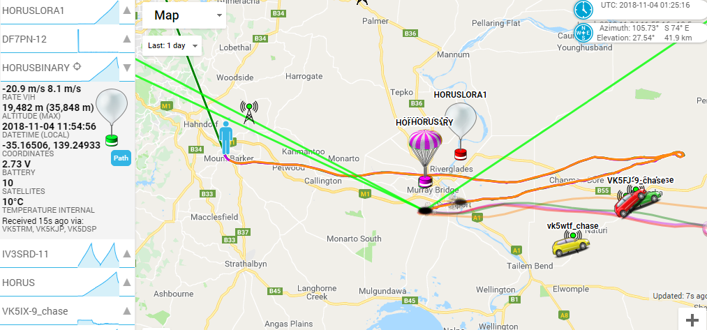
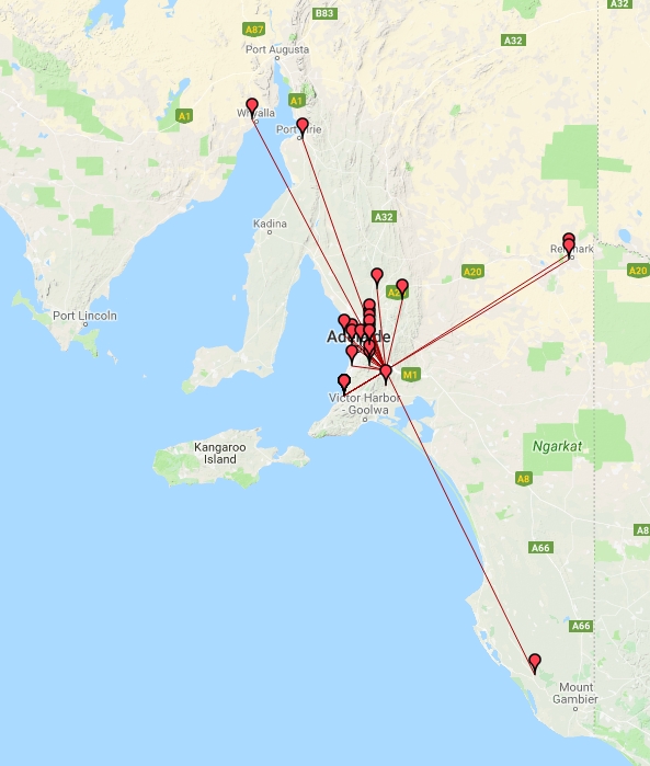
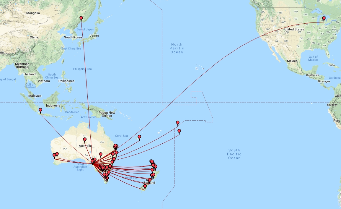
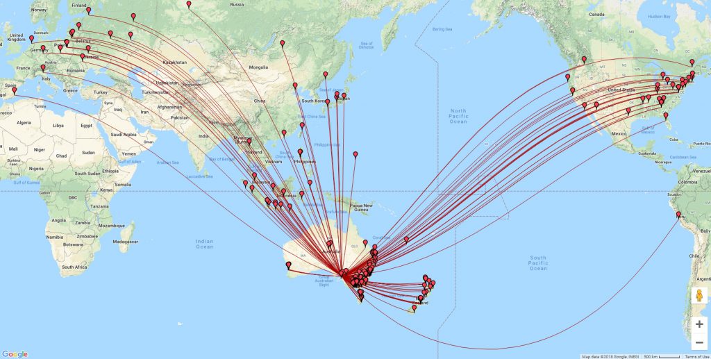
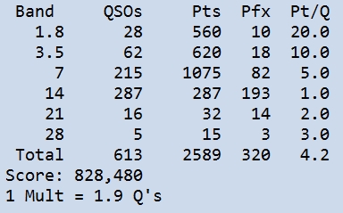
Through the night the score slowly built with the effort invested in the low band station in particular raking in points, although not so many multipliers. 20m proved as always to be the multiplier gathering band. Even so, the following map shows the reach achieved by the 160/80m station:

80m and 160m contacts
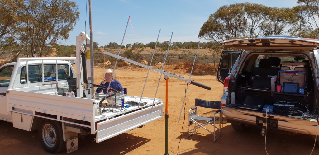
Grant VK5GR driving 80m with Matt VK5ZM working on the SO2R in the background
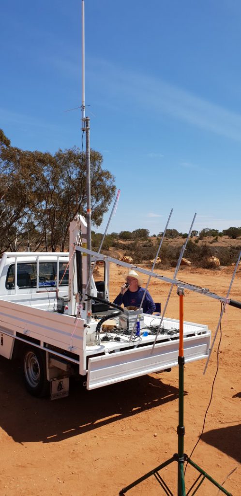
Kim VK5FJ Driving 160/80m
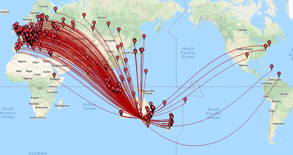
40m meanwhile was powering along as well with lots of traffic from Europe as well as a reasonable amount from North America. Nighttime on 40m was hard going however when the band filled with a huge number of YB contest stations. This should have been a blessing, but obviously their noise floor was such that they couldn’t hear our 400W despite our 5×9 copy of them.
40m Contacts
As the night wore on, 80m was hit by another curse. Two of the dreaded northern radar stations appeared, one taking out 3720-3780 and another taking 3790-3850. For a while we had a 10kHz gap in which to eek out contacts before one of the radars moved down to fill it – thus putting an end to any aspirations of working DX on 80m.
20m meanwhile powered on into the night before giving up on Short Path Europe around midnight. At this point, we entered the “long dark teatime of the soul” in contesting – the graveyard shift where we called incessantly but made little progress. Little did we know that with sunrise things were about to get much worst.
Day 3 – Sunday Morning
The team had been watching the solar forecasts for the preceding couple of days and had reached the point where we were dreading what would happen on Sunday. Sure enough, just when we didn’t want them to, the predictions came true with a geomagnetic storm starting on the daylight side of the planet over the Pacific. We watched as the T index dived lower and lower, creeping across the equator and rendering our North American and later our Asian and European (LP) paths useless.
20, 15 and 10m contacts
Even contact with Japan was problematic. Then the real rub set in. We would call JA stations we could hear, but they would answer with us saying “Sorry no contact JA Only!”. There was a JA domestic contest on and they did not want to give us a QSO! We tried repeatedly Sunday morning on 20m and occasionally on 15m but to no avail. Robbed of our one great hope for prefix multipliers in JA, plus no North American short path (and only a fleeting 20 minute long path NA opening) our score progressed along at a glacial pace.
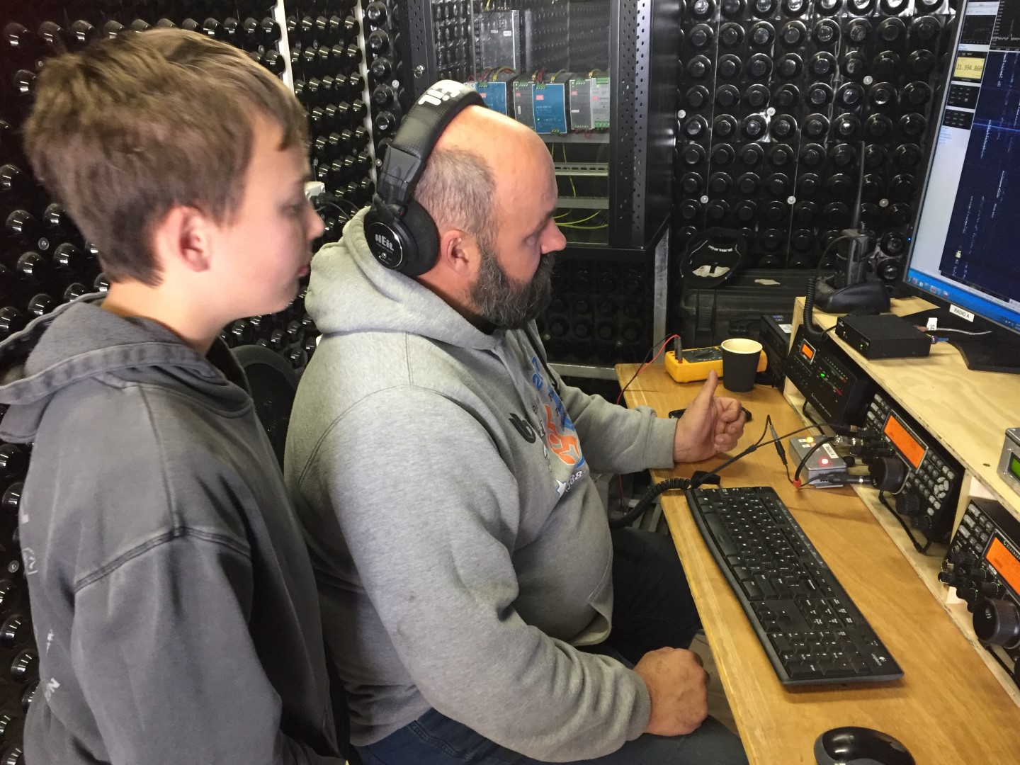
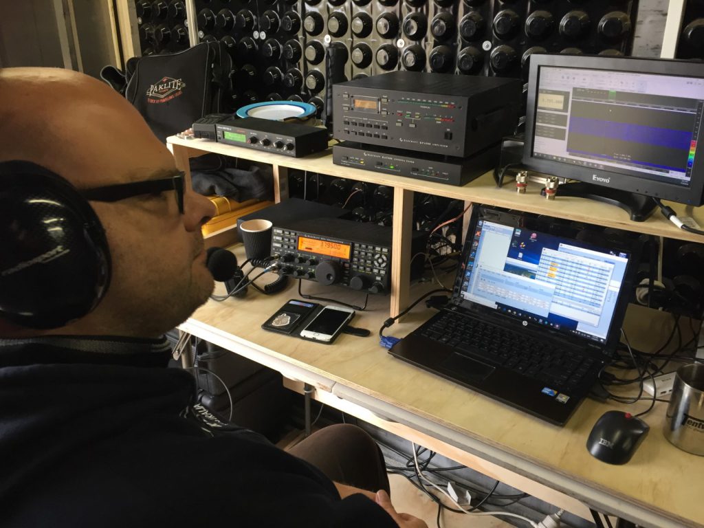
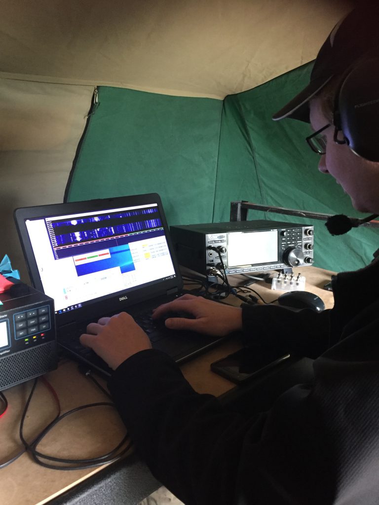
In the face of adversity we soldiered on and took the time to train some new operators. 11 Year old Daniel VK5FDNA, who had only just qualified for his foundation license a few weeks before, was coached through a couple of contacts with his dad Matt VK5ZM.

VK5FDNA learning how to drive the station from dad (VK5ZM)
Meanwhile we also had Gerard VK5ZQV get some practice in as well. It was clear we weren’t going to set any records this year so we decided to use the time we had well, sowing the seeds for next year.
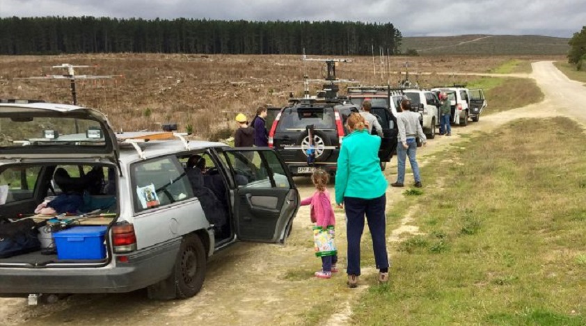
We also had some visitors to the site during Sunday with Ben VK5BB and Olga VK5FOLG making the trip up for a look as did Paul VK5PH. Ady (newly licensed as VK5FADE) brought his family along to see what it was that we had been talking about at the club over the past couple of months. It was great to see some new faces looking to discover what the contest station and scene was all about.
Later in the afternoon 40m came back to life and we were able to put a few more EU and South American stations in the log.
Mark VK5QI Driving 40m
Finally as the contest drew to a close, it seemed on 20m at least as though we ran out of stations to work. The signals we could hear were all in the log. We had even stooped so low as to beg a contact from a couple of VK nets. In the end we could only muster less than half our score from 2017. Given the amount of effort that went in to building the station, a bit of a disappointing result, however a result none the less.
 So, as the sun set over the site, the station wound down. The team then retired to the meals area for a baked potato feast with all the trimmings.
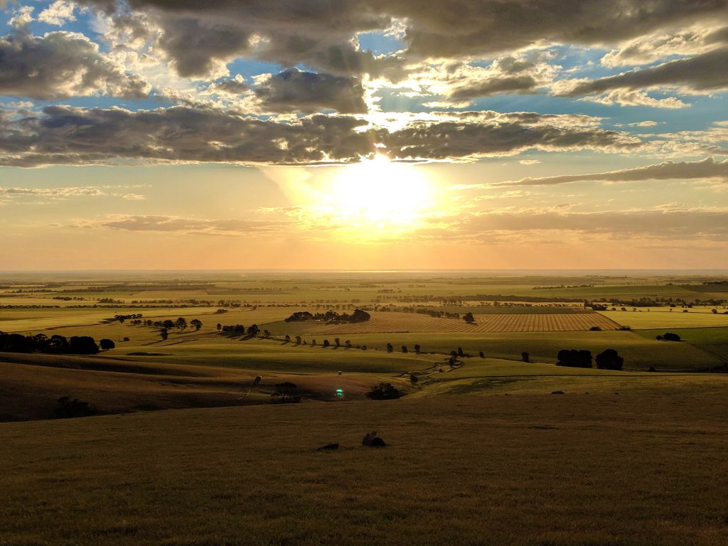
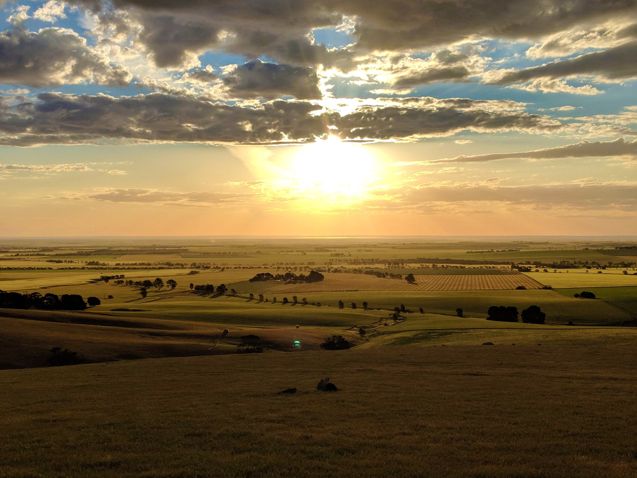
Sunset from Koch’s Hill
After dinner quite a few headed for home and a comfortable bed while the die hards remained on site to work some more DX.
Day 4 – Tear Down
The next morning fresh troops arrived from Adelaide, and the process of packing up began. Our luck with the weather finally failed us with winds approaching 40 knots ripping over the site. None the less, timed between gusts, all the antennas were safely lowered to the ground and carefully packed back into their cases and bags for transport home.
What had taken 2 days to build was secured on trailers and ready to roll in under 5 hours. The remains of the team then headed to Kapunda Bakery for lunch before dispersing back to our home QTHs ready to think about 2019.
Thank You!
The contest band captains couldn’t have done it without all of the help received from members of the club. So in no particular order, we would like to thank the following:
VK5TST, VK5XDX, VK5SFA, VK5GR, VK5AKH, VK5QI, VK5FJ, VK5ZM, VK5FDNA, VK5KX, VK5ZQV, VK5PH, VK5IX, VK5FSAW who all helped design, construct, provide logistics in terms of food and sanitation, man the station on air and then tear down VK5ARG for 2018! (and apologies if I have missed someone). It is a huge team effort each year and this year was no exception.