
In July of 2025 we tried something we hadn’t tried in a while – doing a balloon launch in Winter. Finding a weekend suitable for a large balloon launch in Winter is pretty tricky – the right balance of ground weather conditions (low wind, no rain) and a flight path that doesn’t end up hundreds of km to the east means that launches often get delayed and delayed – and that’s exactly what happened!
The intention of Horus 64 was to re-fly our cross-band repeater payload up to an altitude of at least 35km, allowing repeater coverage between Adelaide and Melbourne. Unfortunately we were never able to get the repeater payload in the air due to poor weather, but we did still do 2 balloon launches with lighter payloads.
Another objective of the launch was to experiment with, and promote the use of the new web-browser-based decoders for our telemetry transmissions. These decoders were developed by Michaela VK3FUR, and make reception of our Horus Binary tracking telemetry, and our Wenet imagery, much more accessible.
Horus 64A – 6th July 2025
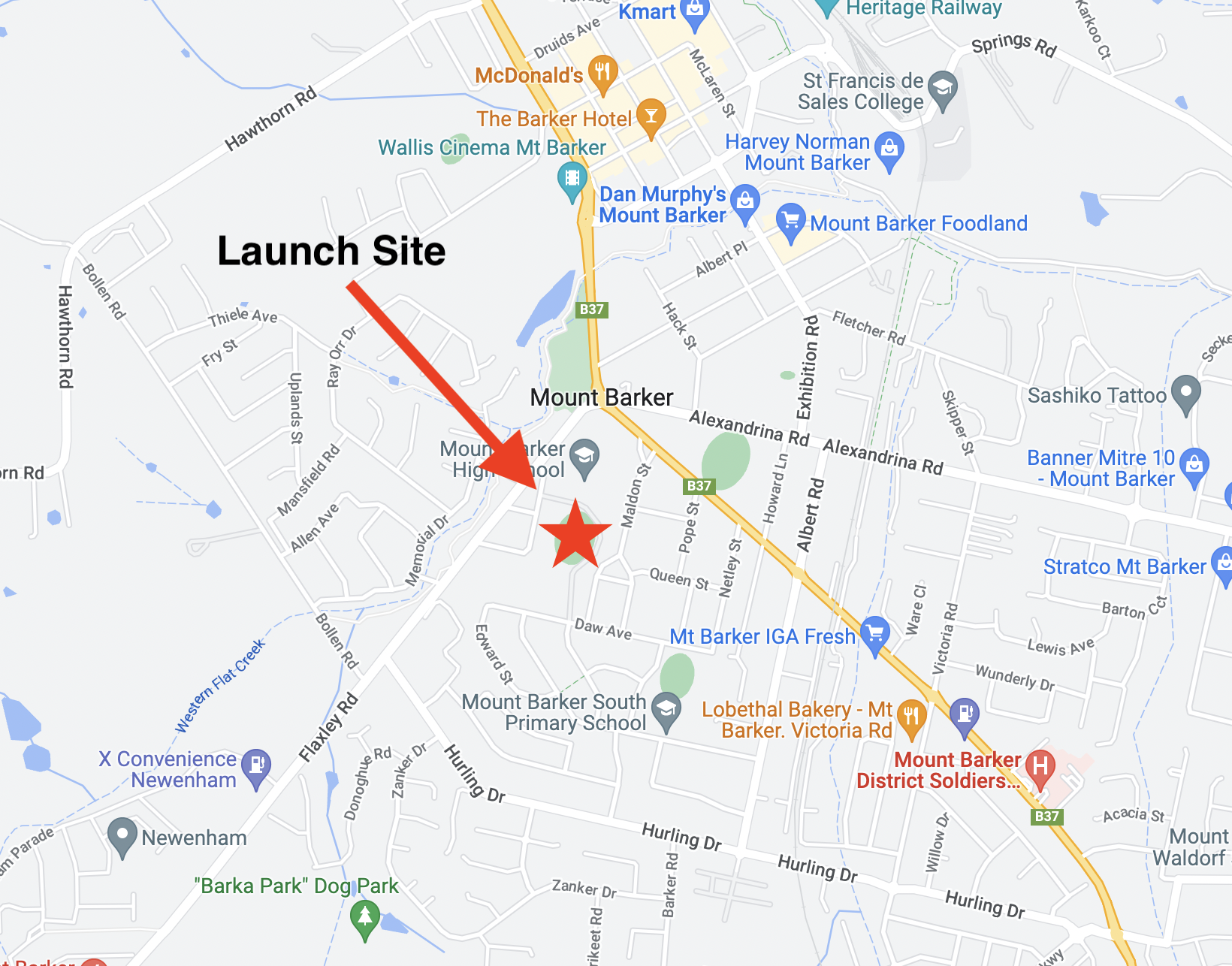
What I’m now calling ‘Horus 64A’ launched on Sunday the 6th of July. It was pretty clear during the preceding week that the repeater launch wasn’t going to be possible, with the flight path prediction landing in inaccessible areas north of Waikerie. The call was made Friday night to scrub the full-size launch and send up a lightweight tracking payload under a small (100g) balloon, to give stations some telemetry to practice reception on.
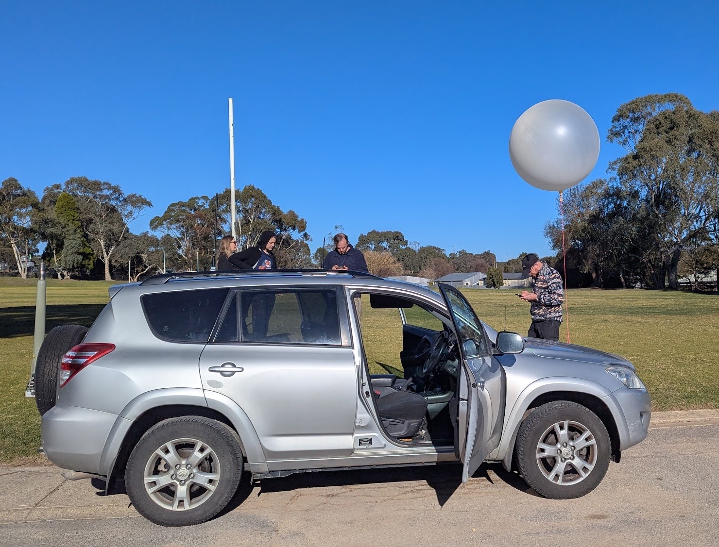
Horus 64A – Waiting for launch.
Weather at the launch site turned out to be ideal, with low winds and clear skies. Unfortunately the flight path predictions were unchanged, so a full launch was still not possible. Mark VK5QI and Will VK5AHV filled the (very small) balloon with a few interested onlookers, and the balloon was released on time at 10AM.
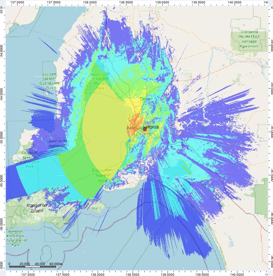
The flight proceeded as expected until about 15km altitude, where we suspect that some of the insulation around the payload gave out, resulting in a sudden drop in temperature and the failure of the tracking payload at just under 17km altitude. No further signals were received. A dashboard showing telemetry from this flight is available at this link.
Thanks to the stations that received telemetry from this flight: BARC-RRR,VK3APJ,VK3APJ-2,VK5AI,VK5AKK,VK5ALG,VK5APR,VK5ARG,VK5CBM,VK5CV,VK5FD,VK5GA,VK5GY,VK5IS,VK5KX-i5,VK5LN,VK5NEX,VK5NTM,VK5QI-9,VK5RK,VK5ST-4,VK5TRM,VK5ZAR,VK5ZBI-1,VK5ZBI-2,VK5ZM,VK5ZMD
Horus 64B – 13th July 2025
Our second try at the repeater launch was for the following weekend. Again, as we got closer to the launch day the weather forecasts were looking pretty poor. This time we had a combination of very high wind speeds at the launch site, as well as a flight path that would take the payloads east into Victoria, landing somewhere inside the Murray Sunset National Park.
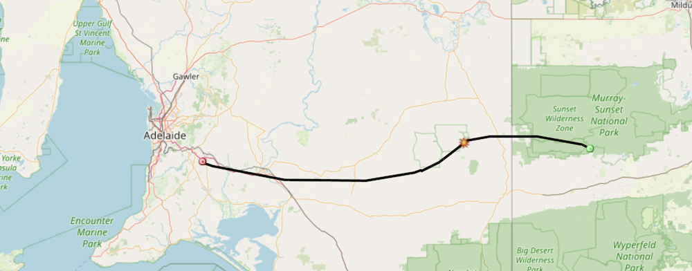
Not a very good flight path prediction!
When it became clear that a full-size launch was once again not going to be possible, the plan pivoted to another smaller launch – this time with a tracking payload *and* an imagery payload, accepting that these payloads might not be recovered on the launch day.
Michaela VK3FUR was able to quickly build up a Wenet imagery payload to fly on this launch. This payload also included software which alternated between the ‘classic’ Wenet modulation (in use since ~2018), and a new ‘Wenet v2’ mode, which is more spectrally efficient. We also added on a PiCam v3 as one last test to see if we could get the auto-focus behaving correctly. Michaela drove over from Melbourne along with Geordie VK3CLR and Alex VK3SNP the day before the launch! You can read her writeup on the payload and flight here.
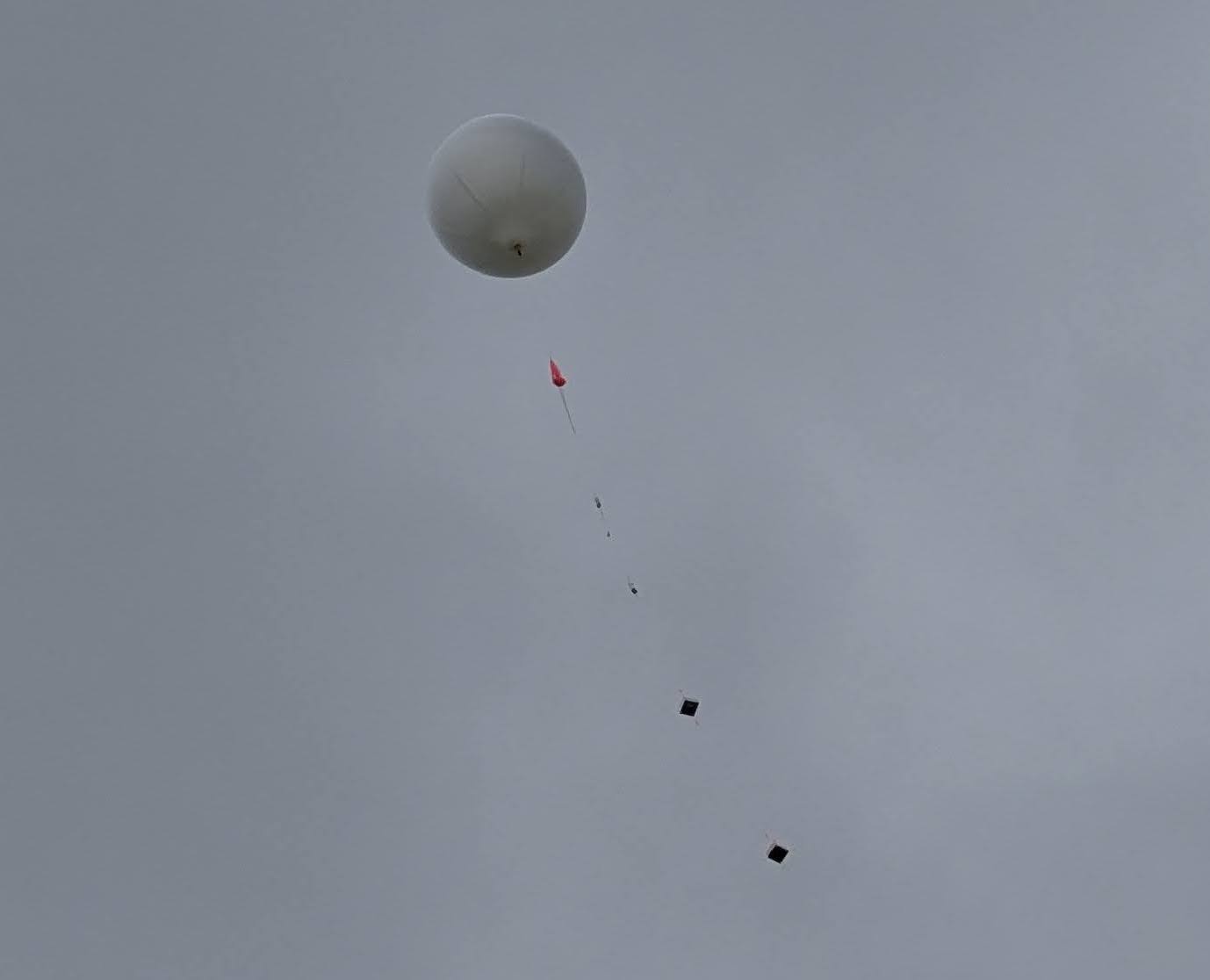
Launch!
On arrival at the launch site, it was immediately obvious that a full-size launch would have been a very bad idea – it was windy! After finding a sheltered spot to fill, it was decided to try flying a 600g Hwoyee balloon to give the imagery payload a bit more time in the area. Filling went fairly quickly, with many hands available to help out with ‘balloon management’.
Launching was a bit more challenging – with wind gusts picking up right as we were preparing for launch, and the balloon almost hitting the ground! The entire launch was captured by Autumn VK5CLD:
Reception Experiments
With the flight heading to the east at over 200 kph we decided it wasn’t worth chasing, and instead headed up to a lookout near Palmer to attempt to track the payloads for as long as possible.
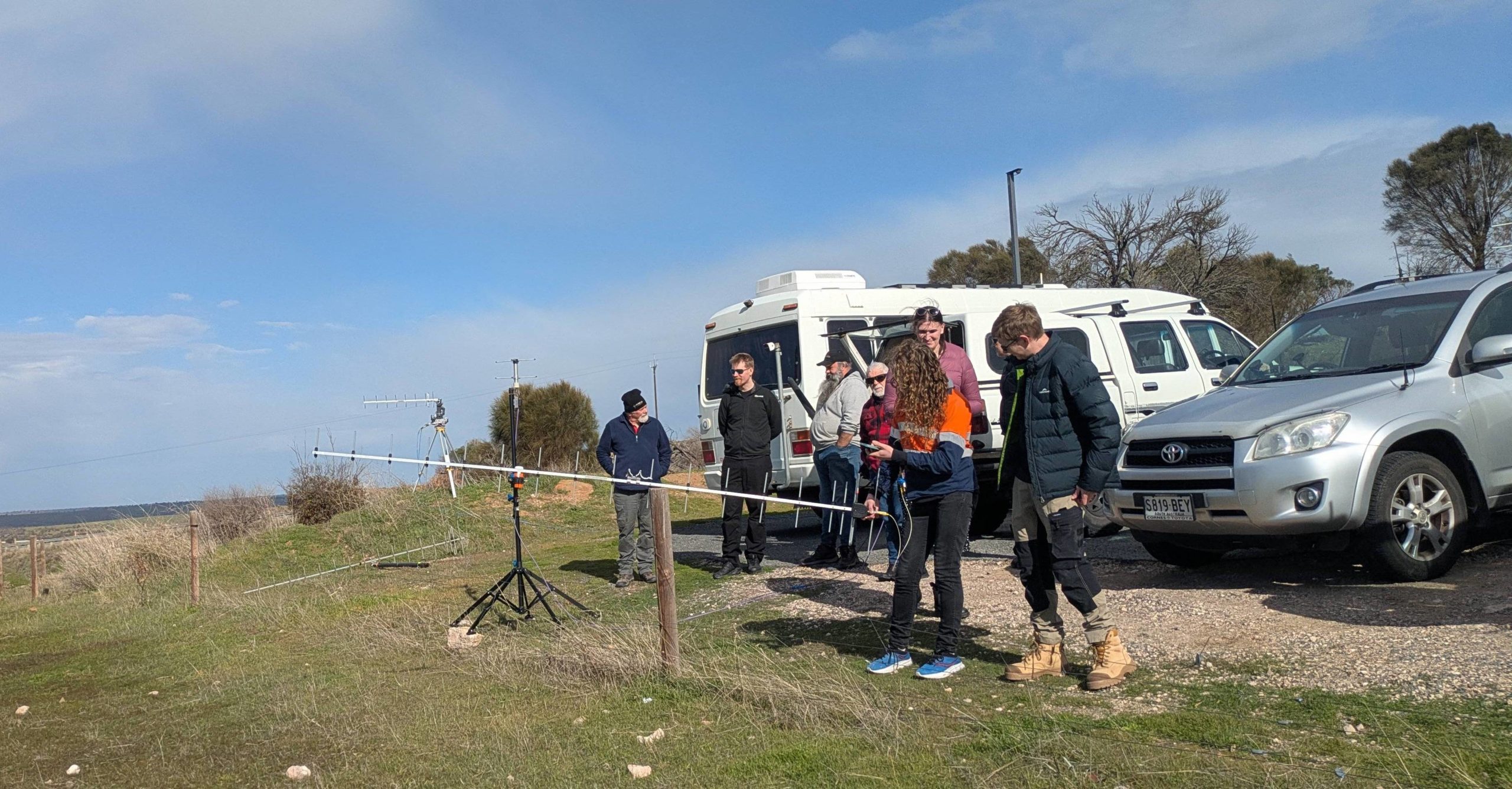
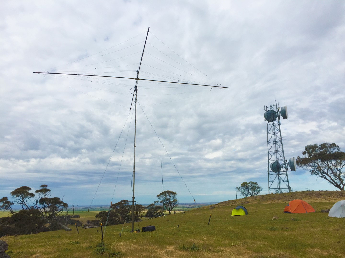
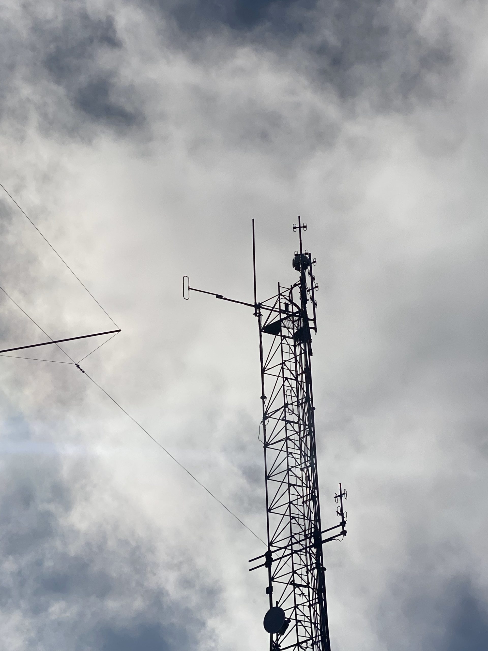
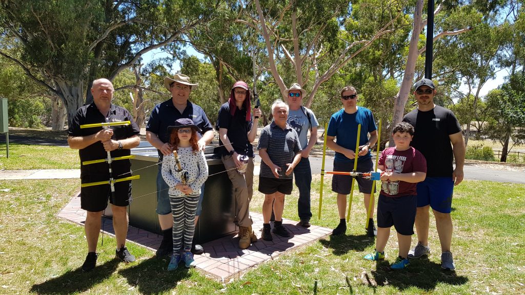
Many different antenna setups receiving imagery and telemetry!
Peter VK5KX and Matt VK5ZM were already on-site, with Pete’s tracking antenna setup, and Matt’s ‘pelican case portable’ receiver. After the launch crew arrived, we had some fun trying out different reception setups, including receiving Wenet imagery using a mobile phone, RTLSDR, and a 18-element yagi! (Worked great, but very difficult to point accurately!). Michaela demonstrated a cheap Wenet reception setup which she describes in her blog post.


Burst, Landing & Delayed Recovery
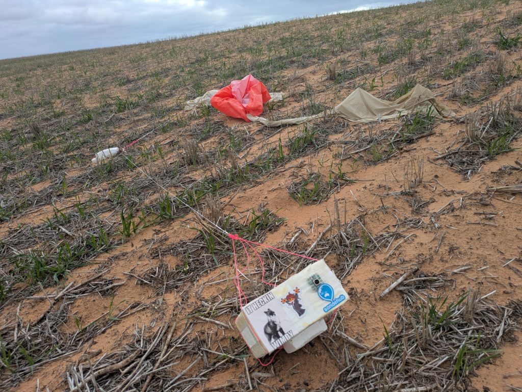
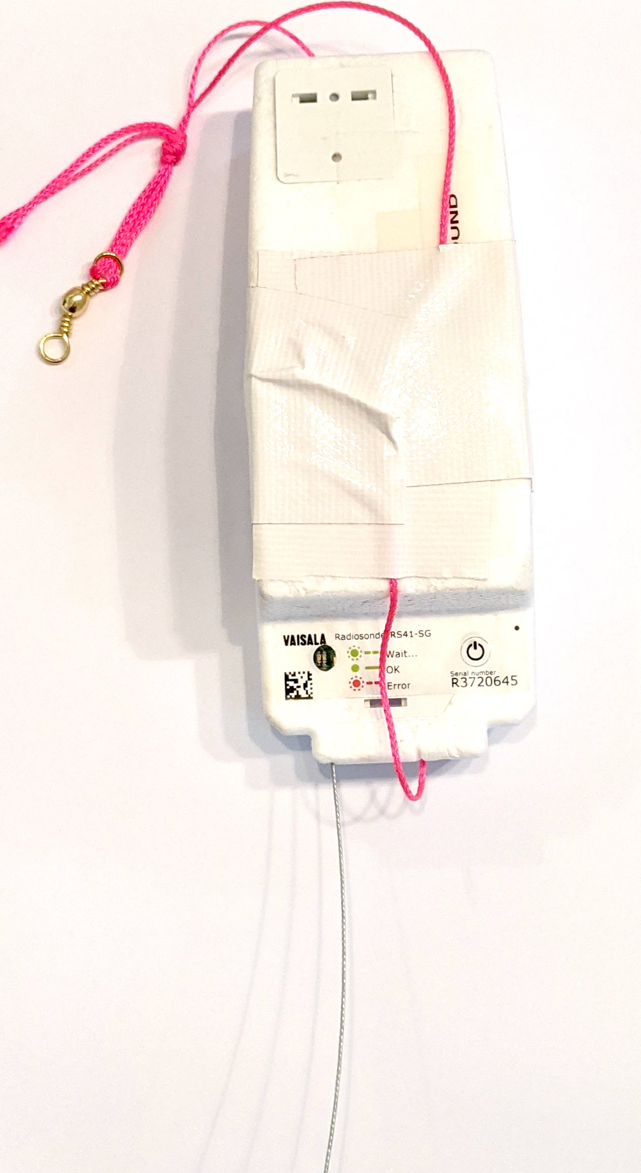
With a 600g balloon, we had expected a burst altitude around 30km. Unfortunately the balloon failed at just over 20km altitude, and we suspect it might have been due to a collision with one of the payloads!
The payloads descended under parachute to a landing approximately 13km north-east of Underbool, Victoria. The last telemetry packet was received by VK5TRM at an altitude of just over 1km, from 130km away. The last imagery packets were received at an altitude around 2.2km by VK5KX’s portable setup, at a range of 250km.
The next day, Michaela & company visited the predicted landing area (a bit of a detour, while heading home to Melbourne) and were able to spot the payloads. A short walk across a paddock, and the payloads were easily recovered.
Michaela was able to create a time-lapse showing the images captured by the payload in the last few hours after landing, before the battery failed:
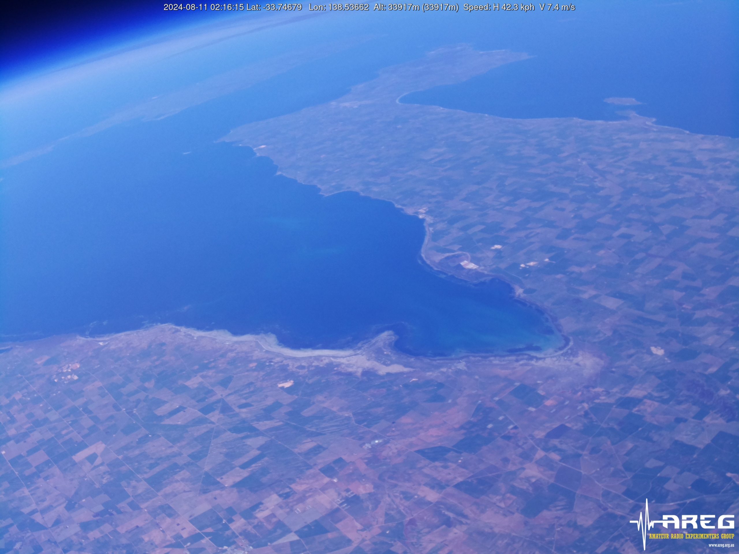
Wenet Payload Imagery
Unfortunately we hit the PiCam v3 focus issues again – this time we think it was caused by the autofocus algorithms not handling the movement of the payloads during flight. Essentially all of the images taken after launch were out of focus. On our next launch we will most likely switch back to the PiCam v2 or PiCam HQ.
The ‘Wenet v2’ modulation performed well, and we’ll be switching to this on all future launches. Further information on how to receive this will be provided before the next launch.
A selection of images from the flight as shown below:


Flight Statistics
The following stations received the ‘ITSWINDY’ Horus Binary Telemetry during this flight: AAA-RX,Angaston-RX,BARC-RRR,VK3APJ,VK3BKQ,VK3FUR,VK3TNU,VK5AKK,VK5ALG,VK5ARG,VK5BRL,VK5CBM,VK5CLD-9,VK5FD,VK5GA,VK5GY,VK5HS,VK5HW,VK5IS,VK5KAW,VK5KX-i5,VK5LN,VK5NE,VK5NEX,VK5PJ,VK5QI-9,VK5RK,VK5ST-4,VK5WE,VK5ZAR,VK5ZBI,VK5ZBI-2,VK5ZM,VK5ZMD,VK5ZQV,vk5cv,vk5trm
The furthest reception was from VK3BKQ near Geelong, at a distance of 495 km!
You can find a breakdown of packets received on the flight dashboard, available at this link.
The following stations received imagery packets from the ‘Wenet Classic’ transmitter (VK3FUR):
- VK5LA: 28413 packets (6.94 MB)
- VK3TNU-2: 45224 packets (11.04 MB)
- VK5KX-9: 23358 packets (5.70 MB)
- vk5cld-2: 4438 packets (1.08 MB)
- VK5QI-9: 24411 packets (5.96 MB)
- VK5HS: 20952 packets (5.12 MB)
- VK5ZM: 6831 packets (1.67 MB)
- VK5CLD-9: 20679 packets (5.05 MB)
- VK3SNP: 225 packets (0.05 MB)
- VK5IS: 15612 packets (3.81 MB)
The following stations received imagery packets from the ‘Wenet v2’ transmitter (VK4XSS):
VK3SNP: 35751 packets (8.73 MB)
VK3SNP-M: 619 packets (0.15 MB)
VK5QI-PHONE : 1252 packets (0.31 MB)
Vk3fur-mobile: 6984 packets (1.71 MB)
VK5ZM: 15631 packets (3.82 MB)
vk3clr: 600 packets (0.15 MB)
VK3FUR: 47417 packets (11.58 MB)
VK5KX-9-v2: 22843 packets (5.58 MB)
Thanks to everyone that received telemetry and imagery on this flight, and in particular thanks to those stations that gave WebHorus and WebWenet a go!
Next Horus Launch – August / September
We still want to try and get the cross-band repeater in the air. This will hopefully happen in late August or early September – information will be posted here once a date is finalised.
We can also announce that we will be performing high-altitude balloon launches for Fleet Space later in the year, as part of their LaunchBox STEM program. The first of these launches is expected to occur in mid-October.