
This flight was a huge success, reading over 40km altitude! Thanks to all that were involved in the launch and received telemetry. A full writeup will be written in the next few days.
The re-attempt of the imagery launch intended for last weekend will now occur this weekend on Saturday the 7th of May, with a planned launch time of 10AM ACDT.
Update Friday 6th May: Launch is GO! With the ~25kph winds forecast for the launch site, we will likely be going with the larger balloon, to avoid having to perform accurate filling.
Weather predictions are still somewhat variable for Saturday, and the final GO / NO-GO decision will be made Friday evening, around 8PM. Check this post on Saturday morning for the final launch decision.
Depending on the weather conditions, we will be launching under either a 600g Hwoyee balloon, with an expected maximum altitude of 28km, or a 1600g Hwoyee balloon, with an expected maximum altitude of 38km(!). This will likely be decided on the morning of the launch based on wind conditions at the launch site. If we go with the larger balloon, the radio footprint of the launch will be approximately 1400km in diameter.
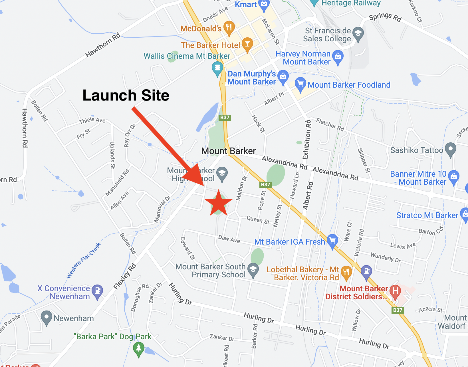 We will be launching from the Mt Barker High School Oval, with the launch team on-site from approximately 9:00AM. Visitors are welcome! Note that there are construction works around the entrance to the oval (off Stephenson Street), but the oval is still accessible.
Tracking of the flight will be available on the SondeHub Amateur Tracker at the following link: https://amateur.sondehub.org/#!mt=Mapnik&mz=9&qm=6h&mc=-34.91296,139.36432&f=HORUS-V2
Assuming the imagery payload works as intended (fingers crossed!), live imagery using the combined contributions of the ‘Wenet’ receiver stations will be available here: https://ssdv.habhub.org/VK5ARG
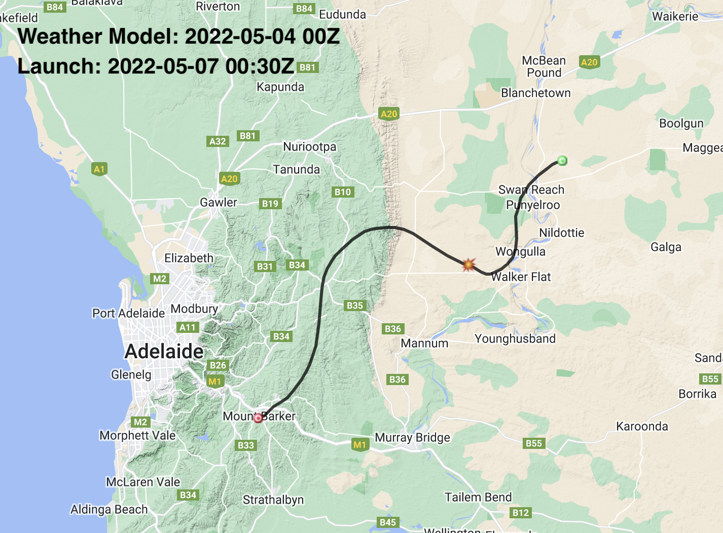
The predicted flight path (for 28km burst altitude) is currently as follows:
Primary Telemetry – 434.200 MHz
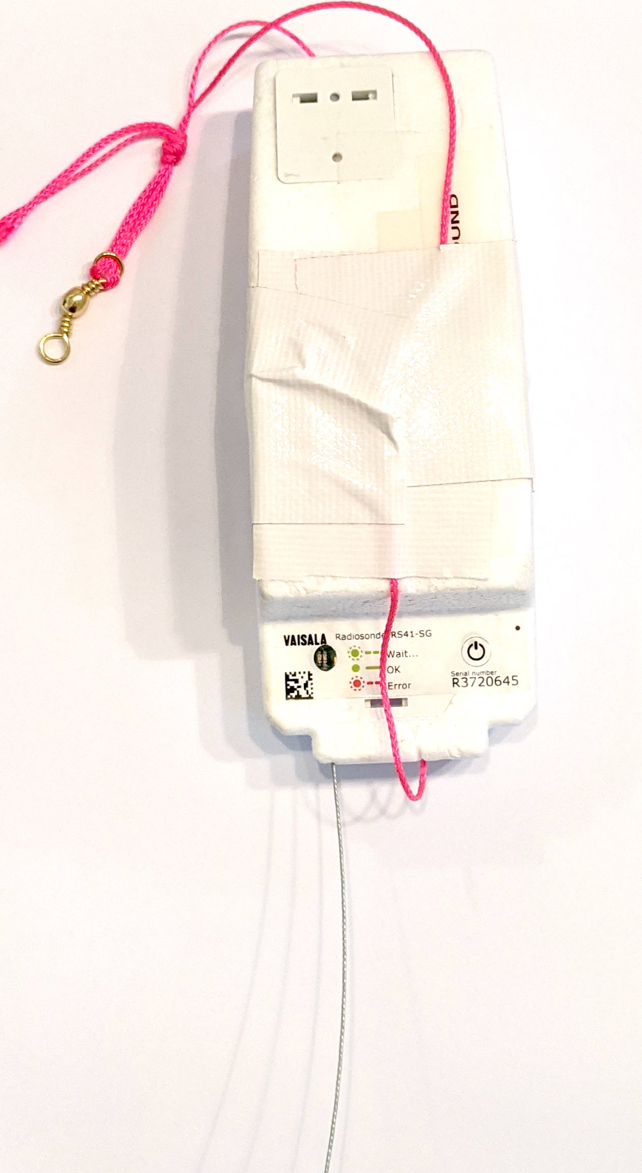 The primary tracking telemetry will be transmitted on 434.200 MHz using the Horus Binary 4FSK data mode. Amateurs in the Central SA region, and even those as far away as Melbourne are encouraged to get involved with the flight through receiving and uploading flight telemetry from our 70cm band tracking beacons. Every piece of telemetry data is valuable to the flight tracking and recovery teams so if you can help join the distributed receiver network to collect that data you will be making an important contribution to the project!
If you try receiving the telemetry from this flight, you’ll need a SSB-capable 70cm receiver (or a SDR), and the Horus-GUI telemetry decoder software. A brief guide on setting this up is available here: https://github.com/projecthorus/horusdemodlib/wiki/1.1-Horus-GUI-Reception-Guide-(Windows-Linux-OSX)
Note that you will need to use a ‘dial’ frequency of 434.199 MHz for the 4FSK signal to be centred in your receiver passband and hence be decodable.
Tracking Details – Imagery – 443.500 MHz
Imagery on this flight will be transmitted via the Wenet downlink system, which uses 115kbit/s Frequency-Shift-Keying to send HD snapshots. Reception of the Wenet imagery requires a Linux computer, a RTLSDR, and a 70cm antenna with some gain (a 5-element Yagi is usually enough).
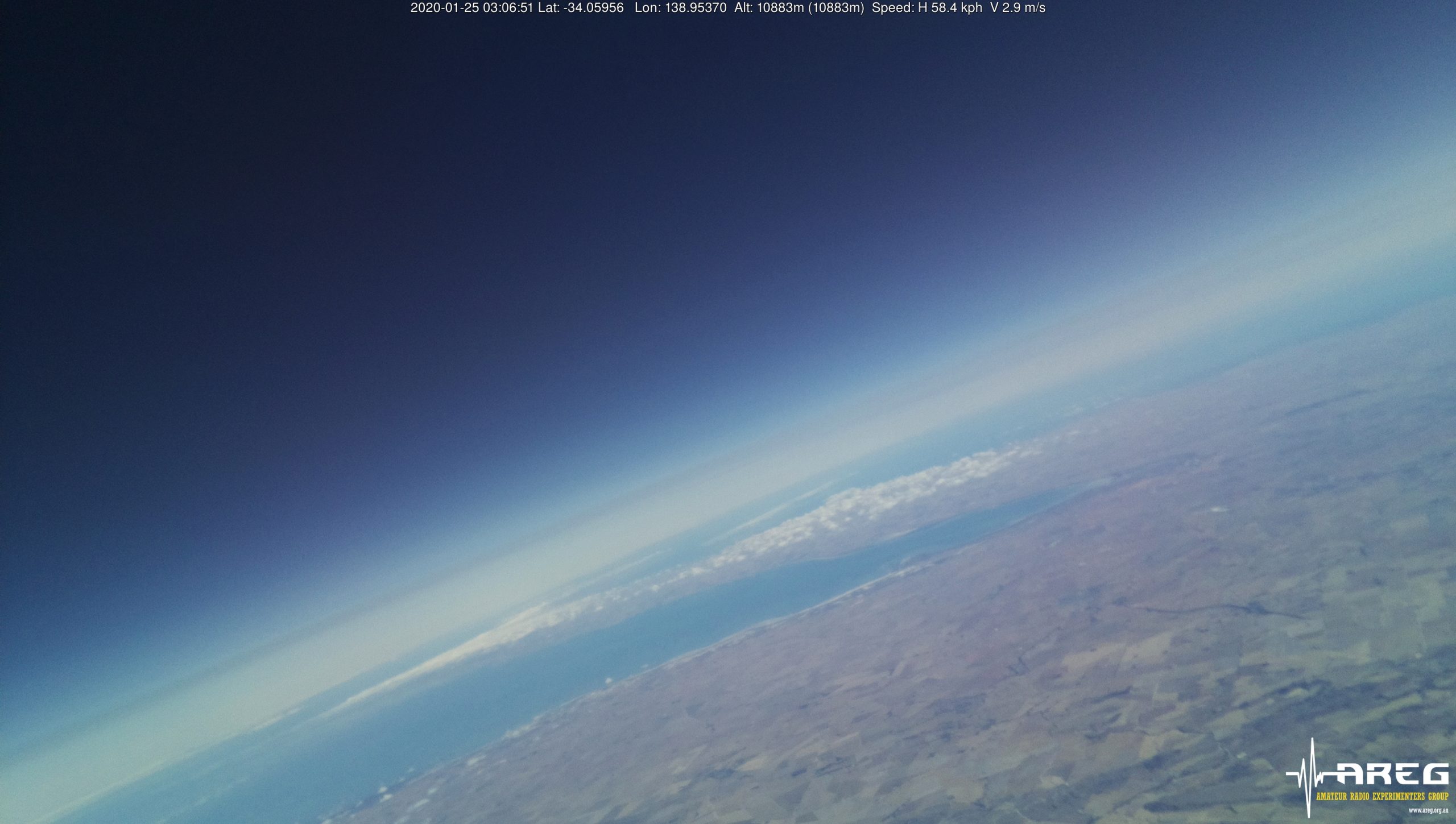
Imagery received via the Wenet payload from a previous flight.
A guide on how to get set up to receive the Wenet signal is available here: https://github.com/projecthorus/wenet/wiki/Wenet-RX-Instructions-(Linux-using-Docker)
During the flight, the live imagery will be available at this link: